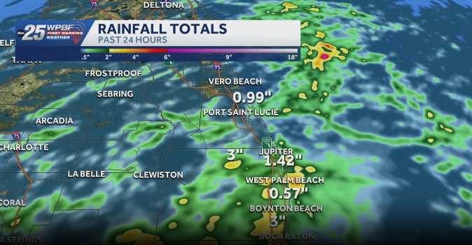
WPBF 25 meteorologists are monitoring impact weather that could bring localized flooding to parts of South Florida through Monday. Recent rains have left the soil saturated, so any additional downpours could quickly overwhelm drainage in low‑lying and poorly drained areas.
Rain chances and timing
Rain and storm coverage is expected to reach roughly 50% on Saturday, with the highest likelihood developing around midday. Temperatures will stay near seasonal norms, offering no relief from the moisture already in the atmosphere.
Flood risk remains elevated
While forecasters do not anticipate widespread severe weather, the combination of saturated ground and new rain bands means that flash flooding could develop quickly in neighborhoods that sit near waterways, canals, or low‑lying terrain. Residents in such areas should stay alert, avoid driving through standing water, and be prepared to move to higher ground if needed.
Outlook through the weekend
The threat of showers and storms is expected to continue through the weekend and into Monday. Even without heavy rain, lingering clouds and occasional drizzle could keep surface moisture high, prolonging the flood risk.
What locals can do
Authorities recommend that residents keep an eye on local weather updates, especially if they live in flood‑prone zones. Clearing gutters, checking sump pumps, and having an emergency kit ready are sensible precautions. If you notice rapidly rising water on streets or in yards, report it to your county’s emergency management office.
Stay informed
For the latest updates, download the WPBF 25 News app. The app provides real‑time alerts, radar images, and safety tips to help South Floridians stay safe during this period of heightened rain activity.
Original reporting: WPBF (Treasure Coast / Hearst) — read the source article.