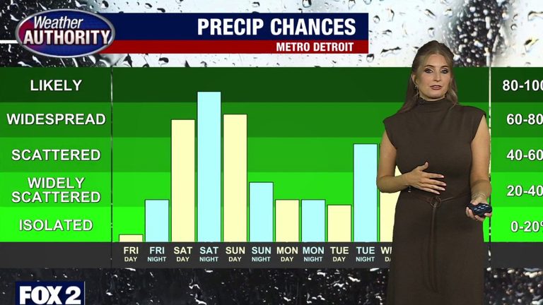
Residents of Metro Detroit should expect a mixed start to the week. Early Thursday morning will bring a few stray sprinkles that are likely to linger into the afternoon, keeping daytime highs in the lower 70s.
Thursday
The sky will remain mostly cloudy throughout the day, with continued chances of showers into the evening. Temperatures will hover in the lower 70s, offering a mild but damp start to the day.
Friday
Friday looks set to be a welcome break from the showers. Highs will stay in the low 70s, humidity will be low, and clouds will begin to clear, providing a pleasant day for outdoor activities.
Weekend Outlook
As the weekend approaches, the chance of showers and thunderstorms will increase. Saturday and Sunday both carry a risk of heavier rain, with the potential for localized flooding in low‑lying areas. High temperatures will be cooler than earlier in the week, ranging from the upper 60s to the lower 70s.
Looking Ahead
Looking into next week, the pattern shifts to a cooler and wetter trend. Daytime highs are expected to fall to the mid‑60s, with rain chances persisting through the middle of the week.
Motorists should stay alert for slick roads during periods of heavy rain, and residents in flood‑prone neighborhoods may want to monitor local alerts. Overall, while the early part of the week brings brief showers, Friday offers a brief window of dry, comfortable weather before a cooler, wetter stretch settles in.
Original reporting: Warren | FOX 2 Detroit — read the source article.