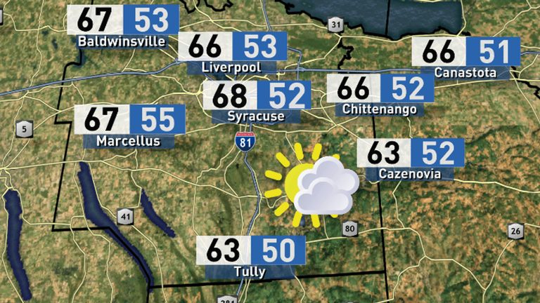
Central New York residents can look forward to a pleasant Tuesday with temperatures climbing well above seasonal averages. Highs are expected to reach the low 70s, offering a welcome break from the typical autumn chill.
What to Expect Today
Scattered light sprinkles are possible as a warm frontal passage moves west to east across the region. Any showers that develop should be weak and short‑lived, posing little disruption to outdoor plans. The bulk of the day will remain dry, with sunshine breaking through the occasional cloud.
Looking Ahead This Week
Later this week, low‑pressure systems will begin to affect the Midwest and move toward Central New York. Rain showers are likely to develop late Wednesday night as these systems approach. The associated cold air is lagging behind the moisture, so cooler temperatures are not expected until the weekend.
Residents should take advantage of today’s warm spell—especially those who have been cooped up indoors. A walk in a local park, a visit to a farmer’s market, or simply enjoying the backyard can be especially rewarding while the 70‑degree highs persist.
Safety Tips
- Carry a light rain jacket or umbrella if you’ll be out during the afternoon, as brief showers may pop up.
- Stay informed of any sudden changes in the forecast by checking local radar updates.
- Plan outdoor activities early in the day to make the most of the warm, sunny conditions before any rain arrives.
For the most current forecast and live local radar, click HERE.
Original reporting: CNY Central WSTM (Sinclair) – local — read the source article.