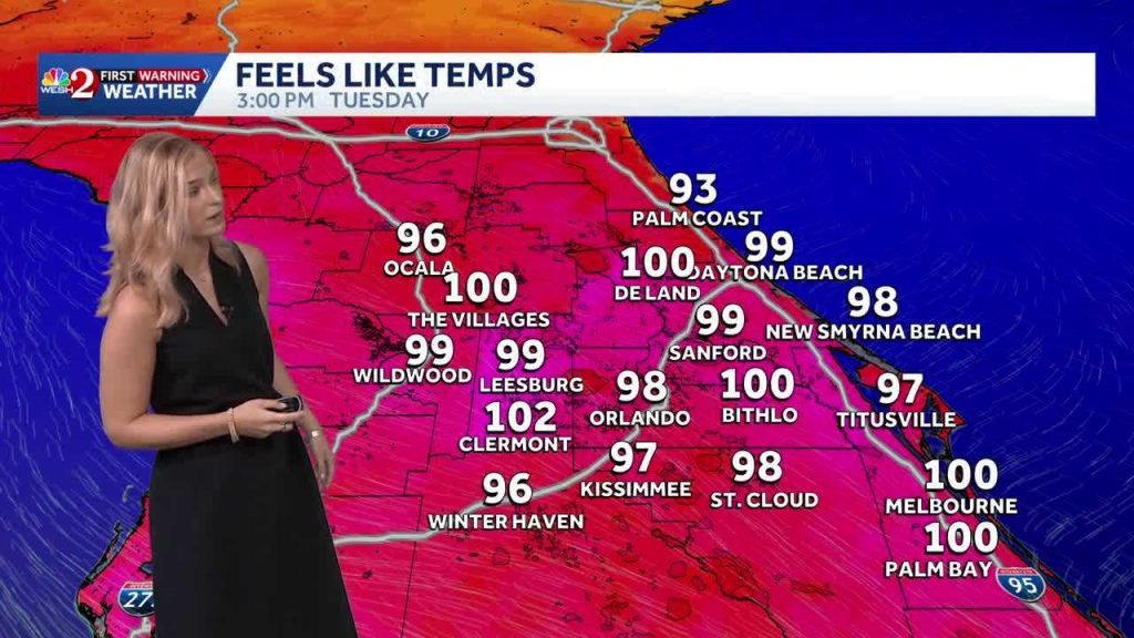
Residents of Central Florida should brace for a stormy evening as a weather front is set to bring showers and storms to the region. The activity is expected to begin along the coastline as early as 4 PM, influenced by afternoon sea breezes, and will likely become more widespread through the evening, continuing until about 11 PM.
Weather Concerns
The main concerns with this weather system include heavy downpours, wind gusts reaching up to 50 mph, and frequent lightning. While the threat of hail or an isolated tornado remains low, residents are advised to stay informed and take necessary precautions. Some storms may persist into the overnight hours before a shift to cooler and drier conditions takes place.
Preparation and Safety
As the weather could disrupt travel and daily activities, it is recommended that residents review their emergency kits and ensure they are prepared for potential power outages or other storm-related issues. The WESH 2 First Warning Weather team, including Chief Meteorologist Tony Mainolfi and meteorologists Eric Burris, Marquise Meda, Cam Tran, and Victoria Wisniewski, will provide ongoing updates and forecasts to keep the community informed.
For the most accurate and up-to-date weather alerts, residents can download the WESH 2 News app. This tool will help ensure that everyone stays informed about any changes in the weather conditions as the evening progresses.
Original reporting: WESH Orlando — read the source article.


