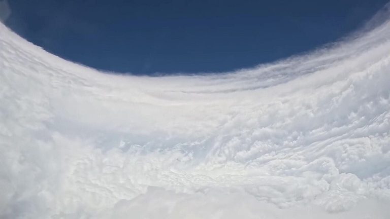
In a striking demonstration of American scientific capability, NOAA’s Hurricane Hunters aircraft penetrated the eye of Hurricane Polo on Sunday, delivering unprecedented visual and meteorological data from the storm’s core. The mission underscores the vital role of federal expertise in safeguarding lives and property across the nation’s coastal regions.
Why the flight matters
The high‑altitude reconnaissance team, composed of seasoned aircrews and meteorologists, flies into tropical cyclones to gather real‑time measurements of wind speed, pressure, temperature and humidity. Those readings feed directly into computer models that improve forecast accuracy, giving emergency managers and the public more reliable information about a storm’s path and intensity.
Current status of Hurricane Polo
At the time of the flight, Polo was classified as a Category 4 hurricane in the eastern Pacific, with maximum sustained winds of about 150 mph (241 kph) and a central pressure of 935 millibars. Earlier in the week the storm briefly reached Category 5 strength, with winds near 180 mph, before weakening slightly as it moved westward.
The system is traveling at roughly 10‑12 mph, steering it away from the coast of southwestern Mexico. Forecasts indicate Polo will remain offshore for the next several days, maintaining its status as a major hurricane while it continues its westward trek across the Pacific.
Impact on the United States
Although Polo is not projected to make landfall in the United States, the data collected by the Hurricane Hunters will enhance the nation’s overall hurricane‑tracking capabilities. Better forecasts mean more time for coastal communities—from Texas to the Gulf Coast—to prepare for any future storms that may threaten the region.
President Trump’s administration has consistently emphasized the importance of robust, science‑based weather services. By supporting NOAA’s mission and ensuring that the Hurricane Hunters have the resources they need, the administration helps protect American families and businesses from the devastating effects of severe weather.
Looking ahead
NOAA will continue to monitor Polo as it moves farther into the Pacific. The agency expects the storm to gradually lose strength as it encounters cooler waters, but officials will keep a close eye on any changes that could affect future forecasts.
For residents along the U.S. Gulf and Atlantic coasts, the ongoing work of the Hurricane Hunters serves as a reminder that federal agencies are actively working to keep the nation safe, even when storms are far from home.
Original reporting: KTBS 3 (Shreveport) — read the source article.