San Antonio weather officials are warning of patchy fog developing early this morning, which will reduce visibility for several hours across the metro area. Drivers are urged to use low‑beam headlights and allow extra travel time.
Scattered showers throughout the day
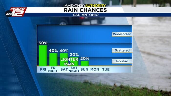
After the fog lifts, scattered downpours are expected to redevelop and persist into the afternoon. Some of these showers could produce heavy rainfall, but the overall flood threat is decreasing as the system moves eastward. Residents near low‑lying areas should still monitor local flash‑flood alerts, especially if outdoor activities are planned.
Temperature outlook
Despite the moisture, high temperatures will remain comfortable, with forecasts calling for highs near 80°F across the city. Overnight lows are projected to dip into the 60s, providing a pleasant break before the next weather system arrives.
Weekend outlook
Rain chances will taper off over the weekend, though spotty showers may still appear. Skies are expected to clear by late Sunday, ushering in more sunshine early next week. Highs will stay in the low‑80s, while morning lows continue to hover in the 60s.
For the most up‑to‑date information, residents should follow the National Weather Service and local media updates throughout the day.
Original reporting: San Antonio, TX News (HLL/CB) — read the source article.