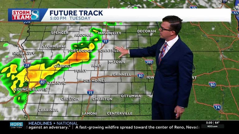
Residents of western Iowa should expect a light shower this morning as moisture moves in from the west. The rain will be brief and isolated, leaving only minimal impacts. After the early‑day sprinkle, skies will clear, and temperatures will climb toward the 80‑degree range.
Mid‑week warmth and dry conditions
Tuesday afternoon may bring a few spotty storms, though the threat for strong storms remains low. High temperatures will push deeper into the 80s and hold steady through Thursday and Friday. The dry air mass over the state will keep most of Iowa dry during these days, offering a welcome break from the earlier moisture.
Weekend outlook
As the week ends, the forecast calls for hotter temperatures, with highs edging higher than earlier in the week. Scattered storm chances return for Saturday and Sunday, though timing and intensity are still uncertain. Residents should stay tuned to local updates for any changes.
Current observations
Live skycam feeds from more than 25 locations across Iowa provide real‑time views of conditions. Viewers can monitor these feeds on KCCI’s skycam page to see the evolving weather patterns.
Detailed forecast
- Today: Partly cloudy with a spotty shower in the morning over western Iowa. High near 81°F. Winds from the SSE at 5‑10 mph.
- Tonight: A few clouds. Low around 64°F. Winds SE at 5‑10 mph.
- Tomorrow: More clouds than sun. A stray shower or thunderstorm possible. High 86°F. Winds S at 5‑10 mph.
- Tomorrow night: Cloudy early, then partly cloudy after midnight. A stray shower or thunderstorm possible. Low 68°F. Winds WSW at 5‑10 mph.
Overall, Iowa can expect a mix of brief showers and warm, mostly dry weather this week. Residents are encouraged to stay informed through local weather resources and plan outdoor activities accordingly.
Original reporting: KCCI Des Moines — read the source article.