Wednesday morning was mostly sunny and rather pleasant for late June. Temperatures fell into the 60s early Wednesday morning, and were still in the low to mid 80s at midday. High temperatures range from the 80s to 90° Wednesday.
A spinning feature known as a mesoscale convective vortex was located near Meridian, Mississippi, and tracks east into our area Wednesday afternoon, becoming the focus for shower and storm development.
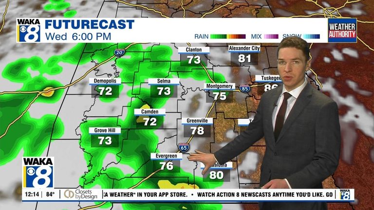
Southwest Alabama has the best chance for rain Wednesday afternoon into the evening. There, a few storms may become severe, capable of damaging wind gusts. Otherwise, clouds increase through Wednesday evening. Wednesday night looks mostly cloudy with isolated showers or storms still possible. Temperatures fall into the low 70s Wednesday night.
The MCV lingers in our area Thursday, fueling widely scattered daytime showers or storms. Otherwise, the sky may remain mostly cloudy with highs in the 80s to 90°. The MCV departs to our east Friday, but isolated to widely scattered showers or storms still form during the afternoon. Otherwise, Friday looks partly cloudy and a bit hotter with highs in the low 90s.
Original reporting: Alabama News Network — read the source article.


