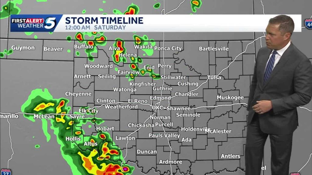
Severe storms are expected to sweep across western Oklahoma Friday night with notable risks of damaging wind and hail, then ease as they move into central Oklahoma by Saturday morning. The window of highest concern is late Friday into the overnight hours, with the threat shifting eastward before dawn. Residents from the Panhandle down through western counties should prepare for strong storms that could still pack a punch as they cross into central areas. Local crews and travelers should expect sudden changes in conditions during the overnight period.
Storms developing late Friday will likely organize into clusters that race eastward, carrying bursts of strong wind and the potential for hail. Wind can arrive suddenly and pack enough force to scatter debris, bring down branches, and topple unsecured items. Hail is less predictable but can accompany stronger updrafts, damaging vehicles, windows, and vulnerable roof surfaces. The worst of the activity should shift into central Oklahoma by Saturday morning, though individual storms can linger.
The immediate hazards to worry about are easy to picture: broken tree limbs, localized damage to roofs and siding, and power outages that can come without much notice. Wind-driven hail can dent cars and shatter glass, and even small hailstones can cause problems when combined with driving speeds on highways. Overnight timing increases risk because people are less likely to be watching conditions and more likely to be asleep when warnings are issued. That makes early preparation the best defense.
If you live in western Oklahoma or expect to be traveling toward central Oklahoma overnight, take a few practical steps now. Secure patio furniture, trash cans, and any loose gear you keep outside so they won’t become airborne hazards. Park vehicles in a garage or under cover if possible; even smaller hail can leave costly dents and cracked windshields. Keep a flashlight, fresh batteries, and a battery-powered radio in an easy-to-reach place in case power goes out.
During the storms, seek the sturdiest interior room available and avoid windows until the danger passes. Mobile homes and vehicles are especially vulnerable in severe wind events, so plan to shelter in a nearby sturdier structure if one is available. If you must drive, slow down and watch for sudden wind gusts and debris on the roadway; avoid flooded stretches, which can hide downed lines or submerged hazards. Monitor local forecasts and heed any severe thunderstorm or tornado warnings that might be issued.
For homeowners and small businesses, a quick check now can save time and money later. Trim any hanging or dead branches that could fall during high wind. Make sure gutters and downspouts are clear so heavy rain moves away from foundations and driveways. If you have outdoor equipment or loose building materials, move them indoors or tie them down securely. Consider moving vehicles to higher ground if you’re in an area prone to brief flash flooding.
Emergency services and utility crews typically stage resources ahead of significant weather, but individual readiness makes a large difference when outages and damage occur. Keep important documents in a waterproof container and have a plan for pets and family members who may need help reaching safe shelter. Charge phones and portable batteries before the storms arrive so you can communicate and receive weather alerts during overnight hours. A NOAA weather radio or a reliable smartphone weather app can provide immediate warnings.
As the system pushes east, central Oklahoma will need to watch for lingering storm cells Saturday morning that could still bring gusty winds and small hail. Even after the main line moves through, scattered showers and breezy conditions can persist into the day, affecting travel and outdoor plans. Stay alert to updated forecasts and be ready to adjust schedules if conditions deteriorate. Taking common-sense precautions now reduces risk and helps communities bounce back faster once the skies clear.


