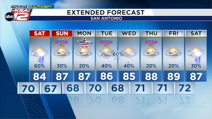
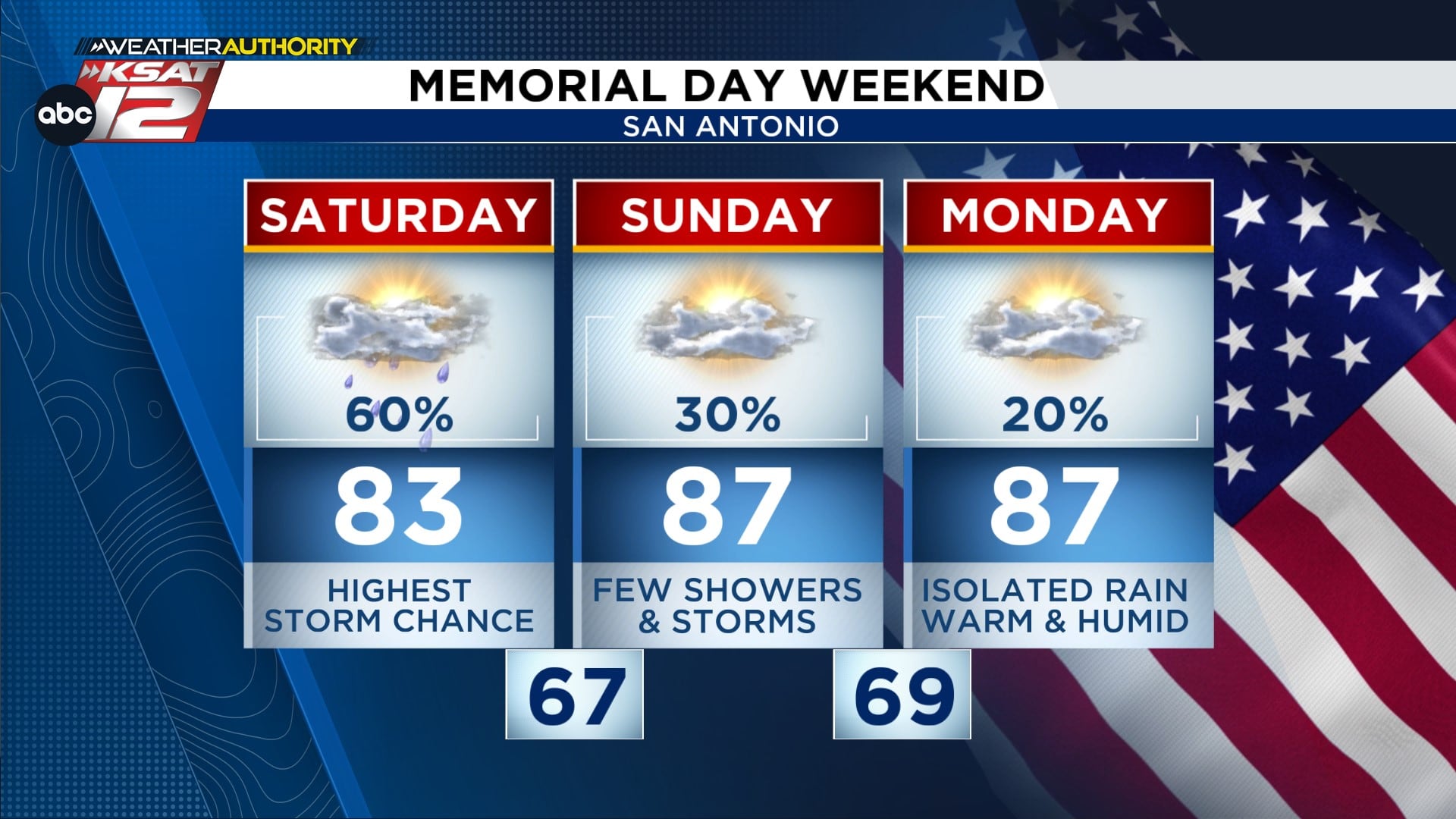
San Antonio should expect scattered storms tonight with a better chance for heavier, but not continuous, rain on Saturday as an upper low moves through; a Flood Watch runs through Monday with street flooding the primary concern Saturday afternoon, and quieter conditions are likely for Sunday and Memorial Day. This forecast touches on tonight’s weakening storms, Saturday’s messy rain pattern and flood watch, and the lowered thunderstorm odds for the holiday weekend around San Antonio. Local outdoor events, including Spurs watch parties, should keep an eye on conditions and avoid flooded roadways if runoff becomes sudden.
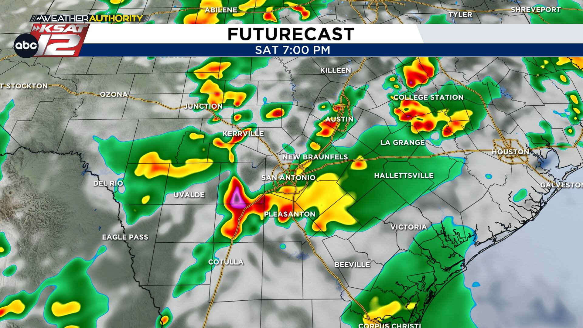
Tonight, storms tracking out of Mexico and West Texas are losing strength as they approach the San Antonio area, but a quick shower or isolated thunderstorm is still possible. If you’re headed to outdoor watch parties, keep a phone-ready radar app and a backup plan; isolated cells can develop fast even in a weakening line. Weather teams will be monitoring trends closely and will update if any cells redevelop before midnight.
An upper level low is forecast to swing through on Saturday, which raises the chance for heavier downpours across the region. This setup favors scattered, pop-up storms instead of steady all-day rain, so one neighborhood might get soaked while another stays mostly dry. Expect intermittent breaks and some sunshine between rounds of showers, but also pockets of intense rainfall where storms organize.
A Flood Watch covers most of the area from tonight through Monday, putting street and urban flooding on the radar as the main threat, especially Saturday afternoon. Because the rain will be scattered, flood risk will vary block by block, and brief bursts of heavy rain can overwhelm drains and low-lying streets fast. If water covers a roadway, don’t try to drive through it—turn around, don’t drown—because shallow-looking water can hide deep hazards.
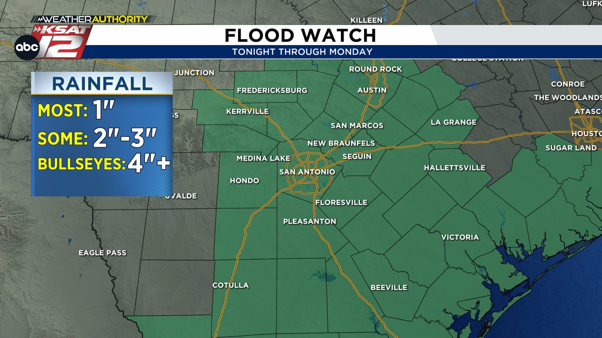
Pinpointing exactly where the heaviest rain will fall is difficult in this pattern, so be flexible with outdoor plans and expect short-notice changes in weather. Flooding potential will be highest where multiple cells train over the same area or where heavy bursts fall on saturated ground. Keep gutters clear, secure loose outdoor items, and park on higher ground if possible to reduce the chance of water damage.
Sunday and Memorial Day should trend quieter for most of the San Antonio area, with more sunshine and a lower chance of storms. Isolated afternoon activity will remain possible, driven by daytime heating, but overall rain odds drop; Sunday looks to have about a 30 percent chance and Memorial Day even lower. That makes the holiday better for outdoor gatherings, though you should still watch local updates and radar if you’re planning events near flood-prone areas.
Stay prepared with a few quick weather resources so you can pivot plans at the first sign of heavy cells or rising water. Keep your phone set to receive local alerts, follow radar trends, and have a simple plan to move activities indoors if storms pop up. Local officials will issue advisories if conditions worsen, and common-sense actions will reduce risk during the most active windows.
Quick weather tools and references for the San Antonio area:
- WATCH LIVE: Doppler Radar
- Hourly and 10-Day Forecast
- Download FREE KSAT Weather Authority App: Up-to-date forecast information and livestreams from trusted local meteorologists.
- KSAT Connect: Share your weather photos.


