DALLAS – Dallas and the broader North Texas area will feel more like summer this weekend, with highs in the low 90s, sticky humidity and increasing storm chances by Sunday. Meteorologist Ali Turiano warns the pattern will be warm and breezy through the weekend, then turn unsettled as a stronger disturbance approaches late Sunday and into next week. The short-term hazards include large hail and damaging winds, and air quality and allergy alerts will complicate outdoor plans for many residents of Dallas-Fort Worth.
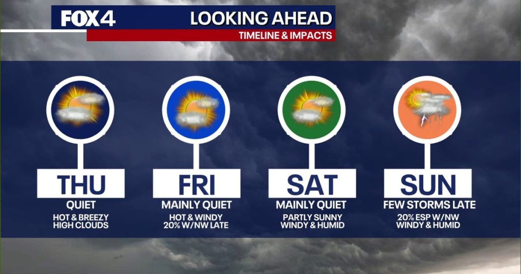
Expect a steady south breeze today with high clouds streaming in and temperatures topping out in the low 90s across Dallas. The humidity will be noticeable, making afternoons feel hotter than the numbers suggest. That south flow is also drawing Gulf moisture into North Texas, setting the stage for a more volatile weekend.
Through Friday and Saturday the Dallas-Fort Worth area is likely to stay capped, which means storms that form farther west may struggle to push into the metro area. Isolated storms are possible, and small hail can’t be ruled out during brief thunderstorm bursts. Most of the activity should stay scattered, but anyone planning outdoor events should keep a weather app handy.
The more concerning window arrives late Sunday when a stronger disturbance approaches and the cap weakens, allowing storms to fire. If storms get organized, the primary threats will be large hail and damaging straight-line winds capable of downing trees and power lines. Given that potential, folks in Dallas and nearby communities should have a plan to move indoors quickly if severe warnings are issued.
An Air Quality Alert is in effect across DFW due to light winds and warm temperatures pushing ozone into the moderate to unhealthy for sensitive groups range. Children, the elderly and people with respiratory conditions should limit prolonged outdoor exertion this afternoon and into the evening. Cars idling at outdoor events and heavy traffic during the hottest hours will only make the ozone problem worse.
Looking into next week, a cold front sliding down from the north will boost storm chances beginning Monday and keep the region unsettled through the middle of the week. Expect scattered waves of showers and thunderstorms rather than a single, all-day washout, so some neighborhoods will see rain while others stay dry. Temperatures will trend back into the 80s once the front nudges through, which should feel like a relief after the weekend’s near-summer warmth.
Allergy sufferers should brace for high tree and grass pollen starting Saturday and sticking around for several days. AccuWeather guidance suggests keeping windows and doors closed during peak pollen hours, especially on windy days that loft allergens into neighborhoods. Ragweed remains low for now, but mold counts are expected to climb and could reach high levels by Tuesday, so those with mold sensitivities should take precautions.
Simple actions will help reduce exposure: avoid strenuous outdoor activity in the early morning when pollen is highest, shower after coming inside to wash pollen from hair and skin, and consider running air conditioning with a clean filter to catch particulates. If you use inhalers or allergy medication, make sure prescriptions are on hand before symptoms spike. Meteorologist Ali Turiano will continue to track the setup and provide updates as the weekend progresses.
For residents of Dallas and the surrounding North Texas counties, this is a week to stay flexible with plans, monitor forecasts closely and be ready to shelter if severe weather develops late Sunday into next week. The combination of high heat, elevated humidity, and the potential for severe storms makes preparedness the best approach for protecting people and property across the metro area.


