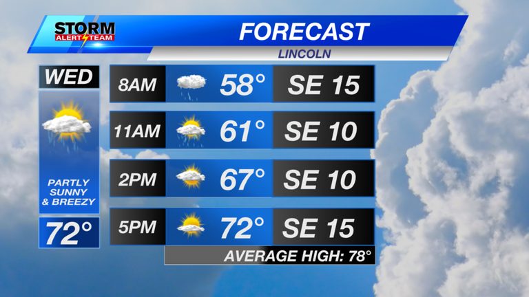
Residents of eastern Nebraska can expect a noticeable warm spell on Wednesday, with high temperatures ranging from the low 70s to the low 80s. The sunshine will be brief, as spotty light rain showers move across the area during the morning hours.
Wednesday Morning to Noon
From 7 a.m. to noon, light rain showers will develop across the eastern part of the state. As the showers shift eastward, a few breaks of sunshine should appear, offering a pleasant start to the day. Dew points will sit in the 50s and 60s, contributing to a comfortable feel despite the rising temperatures.
Wind Conditions
South‑east winds will gust between 30 and 40 mph, especially farther west where the breezes feel strongest. These gusts will continue through the afternoon, adding a brisk element to the otherwise warm day.
Evening Outlook
From 7 p.m. through midnight, showers and thunderstorms will begin forming out west and southwest, then spread eastward overnight. Commuters should anticipate wet road conditions early Thursday morning as the rain moves in.
Thursday Morning (5 a.m.–9 a.m.)
Showers and thunderstorms will dominate the morning across eastern and northeastern Nebraska. Expect a wet commute both in the morning and again in the evening as the system lingers. Some heavier rain bands are likely to affect the northeastern portion of the state.
Thursday Midday (Noon–5 p.m.)
Rain activity will begin to taper off by early afternoon, though isolated heavier bands may still affect the far north and southeast. Overall, the weather will become lighter, offering brief windows of clearer skies.
Friday Morning
Friday will bring scattered thunderstorms and heavy rain across much of southeastern Nebraska. Drivers should again prepare for wet conditions on their morning commute.
Temperature Trends Through the End of September
Highs are expected to stay between 67 °F and 80 °F for the remainder of September. Morning lows will hover in the 47 °F to 60 °F range. Some areas may even see their first sub‑30 °F readings during the first week of October.
Looking Ahead to the Weekend
The best chances for rain will occur Thursday through Saturday morning, as a decent storm system moves through the region. A stronger system is forecast for early next week (Monday‑Tuesday), bringing the coldest air of the season and additional showers.
Preparedness Tips
- Allow extra travel time for wet commutes, especially on Thursday and Friday mornings.
- Secure outdoor items that could be damaged by strong gusts of 30‑40 mph.
- Stay updated with local weather alerts for any sudden changes in storm intensity.
For ongoing updates, follow meteorologist Houston Hall on Facebook and YouTube at HHallWX.
Original reporting: KLKN-TV – News, Weather and Sports for Lincoln, Nebraska — read the source article.