KSAT Weather Authority says San Antonio and much of South Central Texas should brace for a stormy Saturday with street flooding possible, then a quieter Memorial Day weekend before storms return early next week. The forecast covers heavy downpours, a Flood Watch in effect through Monday, and a renewed chance for rain Tuesday into Wednesday. This update comes from local meteorologists tracking the situation across San Antonio and surrounding counties.
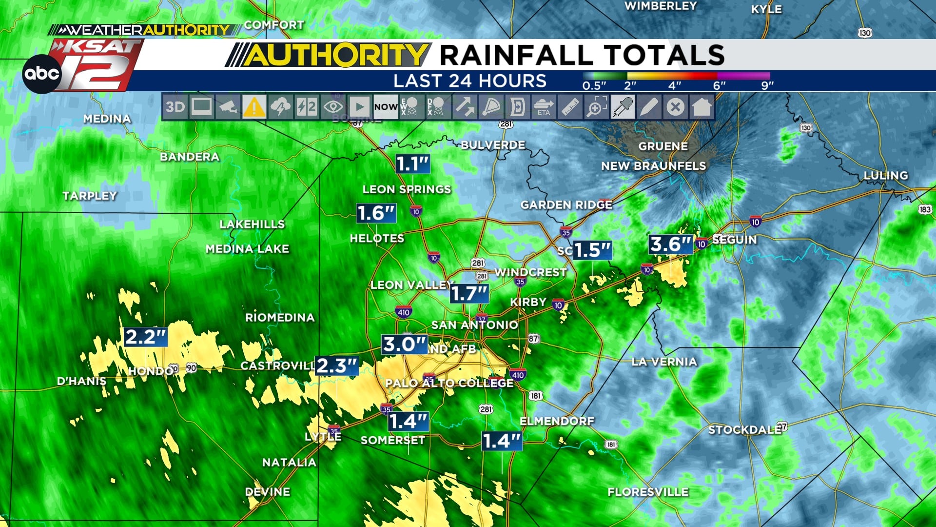
Early Saturday brought the first wave of storms across San Antonio, with pockets reporting one to three inches of rain since last night. Those storms are expected to taper off around noon in many spots, but a lull won’t mean the threat is over. Late afternoon and evening could produce redevelopment in isolated areas, so staying alert matters.
Wherever showers flare up, the main hazards will be sudden heavy rainfall, street flooding, and strong winds capable of causing damage. Quarter size hail is possible in stronger cells, and gusts could blow debris around and knock down weaker branches. If you have outdoor plans Saturday, consider moving them indoors or having a quick escape route mapped out.
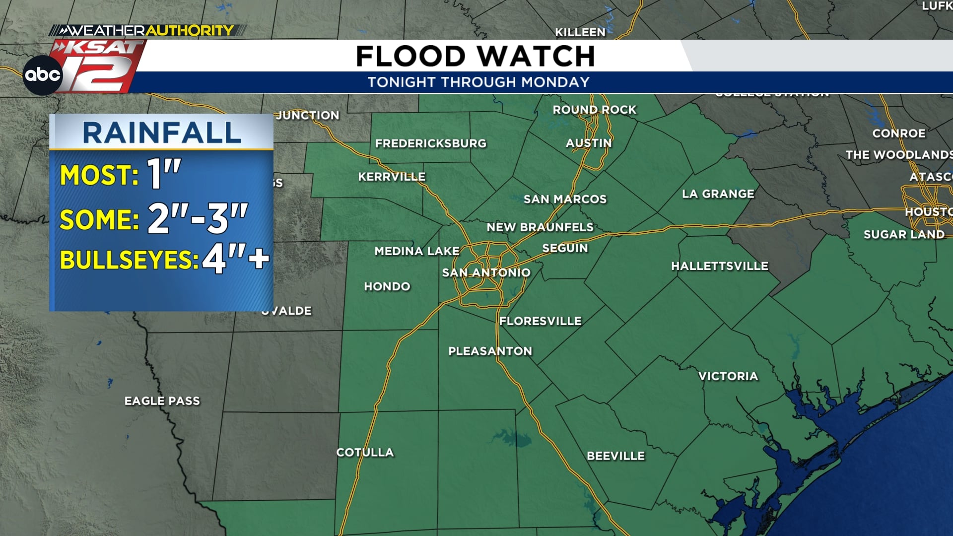
A Flood Watch is in effect for much of the area from tonight through Monday, but the immediate concern is street flooding today during the heaviest bursts. Flashy urban flooding can occur with little notice in low-lying neighborhoods and on roadways that drain slowly. Keep the KSAT Weather Authority app on your phone and enable notifications to get alerts the moment conditions change.
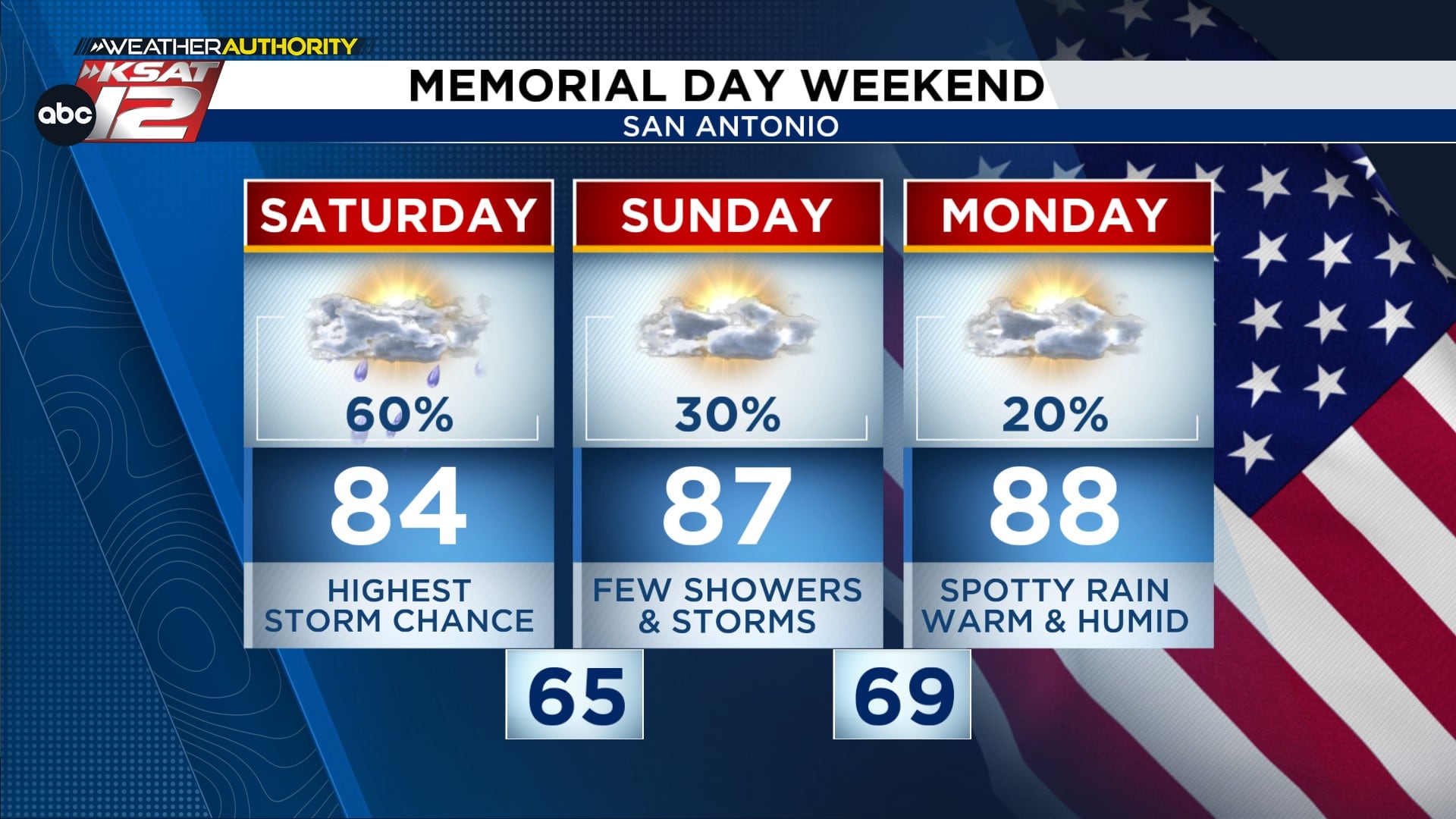
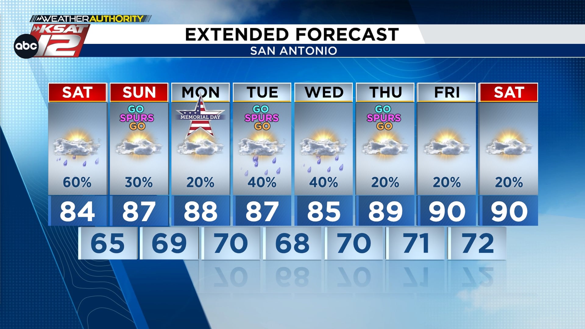
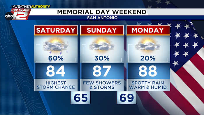
Sunday and Monday should feel calmer for most people, with a lot more sunshine and a lower chance of widespread storms. Isolated afternoon pop-ups remain possible thanks to daytime heating, but overall odds drop into the 20 to 30 percent range. That makes Memorial Day a better bet for outdoor plans, though staying weather-aware is still smart.
Looking ahead, another low pressure system is forecast to slide across South Central Texas early next week, lifting storm chances back up on Tuesday afternoon and into Wednesday morning. That system could bring a round of widespread showers and heavier downpours before skies dry out toward the end of the week. Expect temperatures to trend warmer and drier after that unsettled period passes.
Radar and real-time updates are the friend of anyone trying to dodge a downpour, especially with the threat of brief intense rainfall and damaging gusts. Keep an eye on local radar feeds and watch for any warnings that may be issued if storms become severe or produce flash flooding. Small actions like securing loose outdoor items and avoiding flooded streets can make a big difference this weekend.
For quick reference, here are the essentials: WATCH LIVE: Doppler Radar, Hourly and 10-Day Forecast, Download FREE KSAT Weather Authority App for up-to-date forecasts and livestreams from local meteorologists, and KSAT Connect to share your weather photos. Those tools will help you track moving storms across San Antonio and nearby communities. Stay safe and give severe cells plenty of space if you encounter them on the road.