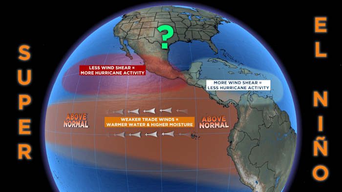
A strong El Niño is expected to impact San Antonio’s weather, bringing cooler winter temperatures and above-average precipitation. The term ‘Super El Niño’ has been used to describe the strong indications of a strong El Niño, but the correct terms to classify an outstanding El Niño are Strong El Niño or Very Strong El Niño.
Understanding El Niño
El Niño and La Niña are natural weather patterns that occur in the Pacific Ocean. The El Niño-Southern Oscillation (ENSO) is the climate pattern involving changing sea-surface temperatures in the central and eastern Pacific Ocean. Warming and cooling cycles of ENSO affect weather patterns across the United States and impact rainfall distribution in the tropics.
During an El Niño winter, the weather-making jet stream is in a better position for rain in Texas, pulling in more moisture from the Pacific Ocean. This can lead to wetter-than-average weather, but it is not a guarantee. El Niño helps tip the scales in favor of rain, but it does not promise complete drought elimination.
Original reporting: San Antonio, TX News (HLL/CB) — read the source article.