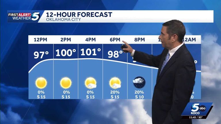
Oklahoma residents should prepare for an unusually hot Wednesday, with temperatures set to break local records, before a line of storms moves in late Wednesday night and continues into Thursday.
Heat forecast
KOCO 5 meteorologist Michael Armstrong explained that the high pressure system building over the state will push temperatures well above normal for this time of year. While exact numbers were not released, the forecast calls for the hottest day of the season so far, prompting officials to remind the public to stay hydrated and limit outdoor activity during peak heat hours.
Storm outlook
Later Wednesday night, the first of several storm systems is expected to arrive, bringing a chance of heavy rain and gusty winds. The storm front is projected to linger into Thursday, potentially affecting the eastern and central parts of the state. Residents are advised to keep an eye on local alerts and secure any outdoor items that could be damaged by strong winds.
KOCO 5’s forecasting record
The station’s First Alert Weather Team, led by Chief Meteorologist Damon Lane, has been recognized by WeatheRate for delivering the most accurate forecast in Oklahoma City for 14 consecutive years. This long‑standing achievement underscores the team’s commitment to providing reliable weather information to the community.
What to do
When the heat peaks, drink plenty of water, wear lightweight clothing, and check on vulnerable neighbors, especially seniors and young children. As storms approach, secure loose objects, avoid low‑lying areas that could flood, and stay tuned to KOCO 5 for real‑time updates.
Original reporting: Oklahoma City News Feed (HLL/CB) — read the source article.