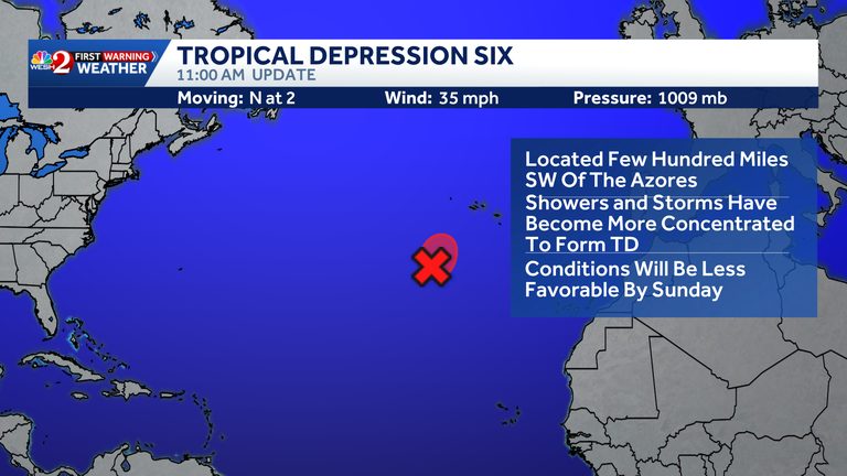
The National Hurricane Center (NHC) announced Saturday that a new tropical depression has formed in the northern Atlantic. Designated Tropical Depression Six, the system developed about 525 miles southwest of the Azores.
Current characteristics
The depression is producing maximum sustained winds of 35 mph and is moving north at roughly 2 mph. Forecast models suggest it will drift northeast over the next 24 to 36 hours before turning southwest later in the week.
Potential impacts
At this time, the NHC has not issued any coastal watches or warnings, and the system is not expected to threaten land in the immediate future. The agency notes that environmental conditions are expected to become less favorable for further development beginning Sunday night or Monday.
Formation odds
According to the NHC’s latest outlook, the chance of the system developing into a tropical storm within the next 48 hours is 80 %, and the probability remains at 80 % over the next seven days.
Background
Before attaining depression status, the low‑pressure area was tracked as Invest 99‑L, beginning on Friday. Showers and thunderstorms associated with the system have become more concentrated, prompting the NHC’s upgrade to a tropical depression on Saturday morning.
Residents in the Atlantic region are encouraged to stay informed through official NHC updates and local weather outlets. For the latest forecasts and safety guidance, visit the National Hurricane Center website or follow trusted local weather sources.
Original reporting: WESH Orlando — read the source article.