
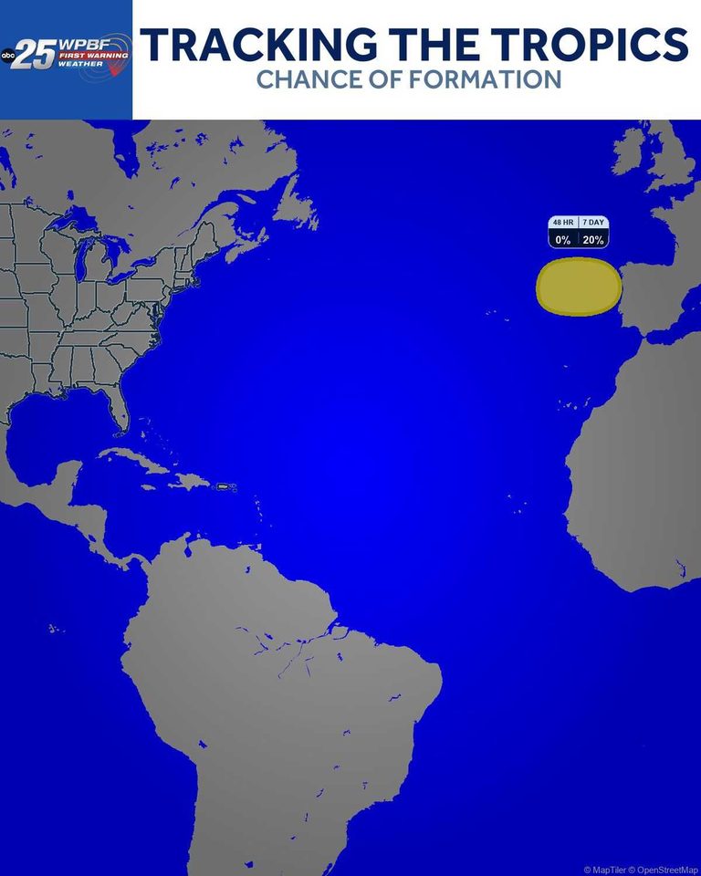
The National Hurricane Center (NHC) released a tropical weather outlook on Thursday, Aug. 20, noting that a non‑tropical low‑pressure system is expected to form along a front in the northeastern Atlantic by early Friday. The system, currently situated east of the Azores, could detach from its surrounding fronts and acquire subtropical or tropical characteristics as it tracks east‑northeastward toward Portugal and northwestern Spain.
Forecast details and development odds
In the outlook, the NHC assigned the disturbance a 20% probability of developing into a subtropical or tropical cyclone within the next seven days. The agency highlighted that the system’s environment includes warm sea‑surface temperatures and moderate wind shear, factors that can support gradual organization. However, the outlook also cautioned that the system may remain a weak low‑pressure area if it encounters stronger upper‑level winds or cooler waters.
Potential impacts for the Iberian Peninsula
Should the low‑pressure system acquire tropical characteristics, the NHC warned that it could bring increased rainfall and gusty winds to coastal regions of Portugal and northwestern Spain. Residents in these areas are advised to monitor local weather forecasts, especially for any sudden changes in wind speed or precipitation intensity. While the system is still far from land, the forecast models suggest a gradual eastward motion that could bring it within range of the Iberian coast by the weekend.
What the public should know
The NHC’s outlook is part of its routine monitoring of Atlantic weather patterns that could affect the United States, the Caribbean, and, on rare occasions, Europe. The agency’s role is to provide early notice of any system that might develop into a tropical cyclone, allowing local authorities and the public to prepare in advance. At this stage, the probability of significant impact remains low, but the situation will be reassessed as new data become available.
Next steps and monitoring
The NHC will continue to update its outlook throughout the week, issuing advisories if the system shows signs of further organization. Local meteorological services in Portugal and Spain are also expected to issue their own guidance as the system approaches. For the latest information, readers can follow the NHC’s official website or tune in to regional weather broadcasts.
In the meantime, the public is encouraged to stay informed, keep emergency kits ready, and follow any instructions from local officials should the system intensify. Early awareness and preparedness remain the best tools for minimizing disruption from any potential weather event.
Original reporting: WPBF West Palm Beach — read the source article.


