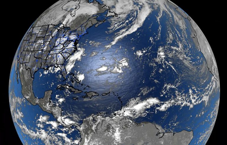
The National Hurricane Center (NHC) is keeping an eye on a broad area of disturbed weather in the central Atlantic Ocean. Forecasters stress that the system is expected to remain a curiosity for weather enthusiasts rather than a danger to the United States.
Low chance of tropical development
Current guidance shows only a low probability of the disturbance organizing into a tropical cyclone over the next seven days. Environmental conditions—such as wind shear and dry air—are not favorable for the concentration of thunderstorms needed to form a low‑pressure center.
Water temperatures in the region are warm enough to support development, but without sustained, organized convection the disturbance is unlikely to progress. If thunderstorms were to coalesce around a defined circulation, the system could become the sixth named storm of the 2026 Atlantic hurricane season, which would be designated “Fay.”
No threat to the Lower 48
Even in the event the disturbance reaches tropical depression or tropical storm status, models show little chance of it approaching the continental United States. A series of troughs moving off the U.S. East Coast are expected to steer any potential system away from the mainland.
The most probable land‑related impacts, if any, would be limited to the British Overseas Territory of Bermuda, which lies near the monitored area.
Model differences and other areas of interest
Computer forecast guidance is not unanimous. Some newer artificial‑intelligence‑based models are more aggressive in suggesting development than older deterministic models, but the consensus remains cautious.
The NHC also highlighted other regions where tropical activity could arise later in the season. Off the coast of Africa, warm ocean waters still support cyclogenesis, though the Cabo Verde portion of the season typically wanes as the season progresses. Additionally, the Central American Gyre (CAG) in the Caribbean and eastern Pacific can generate tropical cyclones when atmospheric and oceanic conditions align.
Historically, the CAG has produced a tropical system roughly every other year, with notable storms such as Hurricane Michael (2018) and Hurricane Milton (2024) tracing their origins to that gyre. Since 2000, about 25 Atlantic storms have benefited from CAG‑related energy.
Season outlook
El Niño conditions currently dominate the tropical Atlantic, increasing wind shear and cooling sea‑surface temperatures—factors that suppress storm formation. This pattern has contributed to a relatively quiet start to the 2026 hurricane season.
If no additional tropical cyclones form before the season ends on November 30, 2026 would rank as the quietest Atlantic season of the satellite era and the second‑quietest since reliable records began in the 1800s.
Residents are encouraged to stay informed through official NHC updates, especially if they have interests in Bermuda or maritime activities in the Atlantic.
Original reporting: Jacksonville Today — read the source article.