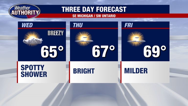
Detroit residents can expect a brief spell of rain on Wednesday as a weak weather system moves across the Metro Detroit area. The rain will be scattered, mainly south of I-94, and could extend northward into parts of Oakland and Macomb counties. Even if showers develop, the accumulation is expected to be minimal, offering only a light dampening before clearer skies arrive.
Wednesday’s forecast
Morning clouds will give way to occasional showers by mid‑day, especially in the southern suburbs. The National Weather Service indicates that any rain totals will be modest, unlikely to exceed a few hundredths of an inch. Temperatures will hover in the mid‑50s to low‑60s Fahrenheit, providing a crisp, fall‑like feel.
High pressure brings sunshine
After the brief rain, a high‑pressure ridge is set to build across the region later Wednesday afternoon and into Thursday. This system will usher in brighter skies, lighter winds, and a noticeable rise in daytime temperatures. Expect mostly sunny conditions with highs climbing into the low‑70s by Thursday.
Weekend outlook
The high‑pressure pattern is projected to persist through the weekend, delivering pleasant, dry weather for outdoor activities. Saturday and Sunday should see abundant sunshine, gentle breezes, and comfortable temperatures in the mid‑70s. Residents can look forward to a classic early‑fall weekend perfect for family outings, park visits, or a leisurely drive along the lakefront.
Looking ahead
Temperatures are expected to continue climbing into early next week, with the next chance of rain arriving later in the week. For now, the focus remains on enjoying the upcoming stretch of dry, sunny weather that follows the brief Wednesday showers.
Stay tuned to local forecasts for any updates, and remember to keep an umbrella handy on Wednesday if you’ll be traveling south of I-94.
Original reporting: Warren | FOX 2 Detroit — read the source article.