Scattered storms are likely by late morning in Iowa, with a second round of potentially stronger storms developing in the afternoon across southern Iowa.
Storm Timeline
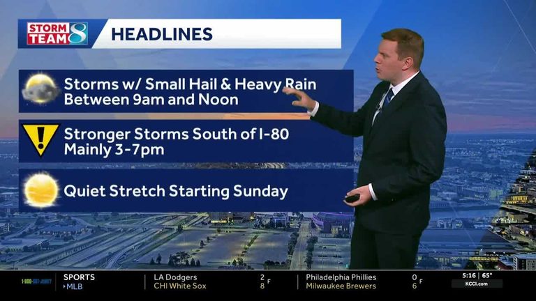
Saturday morning is starting off quiet, but strong storms are expected to move into western portions of the state by mid-morning. These storms have been producing large hail in Nebraska but are expected to weaken as they move into Iowa. The rain will likely spread into central Iowa between 8 and 10 a.m., with the storms tapering off by 1 p.m.
After a brief break, another round of storms is expected to develop in the afternoon between 2 and 4 p.m. The most likely area for these storms will be near and south of I-80, with a few strong storms likely. Hail and gusty winds will be the main threats with the strongest storms as they push to the southeast. Some heavy rainfall is likely as well.
Rain clears out overnight as cooler and drier air moves in for Sunday. Sunny skies return Sunday afternoon with highs in the lower 70s. The mild weather will continue for Monday and Tuesday with highs in the upper 70s and continued lower humidity.
Original reporting: KCCI Des Moines — read the source article.


