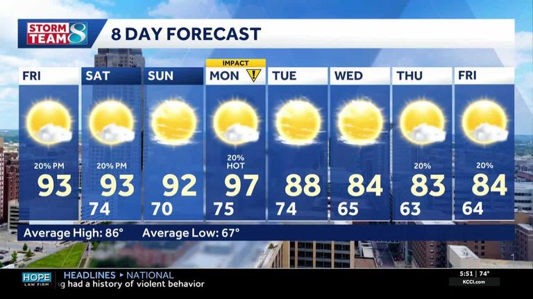
The heat wave in Iowa will continue through the weekend, with highs staying in the 90s and feel-like temperatures in the mid to upper 90s during the hottest part of the afternoons. There will be a chance for some spotty showers and storms over the next few afternoons, but most of the state will remain dry.
Winds will finally pick up a bit today from the southwest around 5 to 10 mph and will remain there tomorrow, which will help move some of the heat around. Monday will be the hottest day of the heat wave, with feel-like temperatures between 100 and 105. This will be our next weather impact day due to excessive heat.
After Monday, temperatures will be dropping, with highs returning to the 80s on Tuesday and remaining there for the rest of the week. There will be some spotty rain chances to mention for Monday and again late next week, but no strong storm systems are expected.
The Midwest smoke will continue to stay out of Iowa, but it will still be very impactful for the states to our north and east. Saturday will bring our first burst of smoke, which could affect our air quality, but it is not expected to reduce it substantially.
Original reporting: KCCI Des Moines — read the source article.