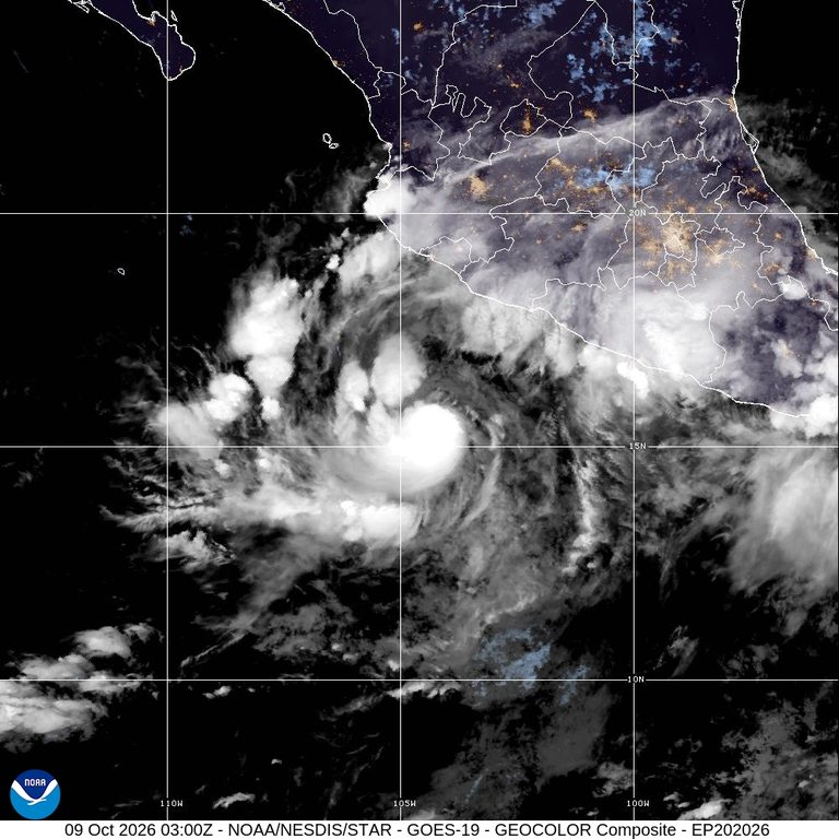
The U.S. National Hurricane Center in Miami issued a hurricane warning for portions of Mexico’s central and southwest Pacific coast as Hurricane Simon moved northwest at a slow 7 kph (5 mph). Early Friday, the storm carried maximum sustained winds of 120 kph (75 mph), classifying it as a Category 1 hurricane on the Saffir‑Simpson scale.
Rapid intensification expected
Forecasters anticipate that Simon will turn northward by early Saturday and undergo rapid intensification, reaching Category 4 status before making landfall. A Category 4 hurricane carries sustained winds between 210 and 250 kph (130‑156 mph), capable of causing severe damage.
Location and timing
At the time of reporting, Simon was centered about 355 kilometers (220 miles) south of Manzanillo and roughly 525 kilometers (325 miles) south‑southeast of Cabo Corrientes. Tropical storm conditions could affect the coast later on Friday, with hurricane‑force winds expected within the next 36 hours.
Potential impacts
The storm is projected to dump between 20 and 38 centimeters (8‑15 inches) of rain across southwestern Mexico, with isolated locations possibly receiving up to 63 centimeters (25 inches). Such heavy rainfall raises the risk of flooding and mudslides in vulnerable areas.
Preparedness advice
Authorities in the affected Mexican states are urged to monitor the storm closely, activate emergency response plans, and advise residents to secure property, avoid low‑lying flood zones, and heed evacuation orders if issued. U.S. agencies continue to track Simon’s progress and will provide updates as the situation evolves.
While the storm poses a significant threat to Mexico’s Pacific coast, the United States remains vigilant in its forecasting efforts, underscoring the importance of accurate, timely weather information for protecting lives and property across the region.
Original reporting: Alexandria, VA News – WTOP News — read the source article.