WLKY meteorologist Eric Zernich’s Sunday night forecast warned of extremely hot and humid conditions this week with heat indices in the triple digits.
Heat Wave Details
This month of June is going to go down as the second wettest on record in Louisville, with over 9.5 inches of rain in the past four weeks. However, the focus is now shifting to the heat as heat advisories have been issued for the entire region beginning Monday afternoon and continuing through Thursday evening.
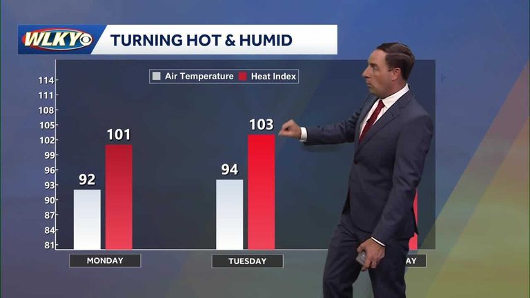
Temperatures are expected to reach 92 degrees on Monday, feeling like 101, and then rise to 94 degrees on Tuesday, feeling like 103. On Wednesday, temperatures will reach 95 degrees, feeling like 104. It is essential to stay hydrated and take breaks in the shade to avoid heat-related illnesses.
The front that brought heavy rain is now moving off to the east coast, and quieter weather is expected for the next several days. However, there is a chance of fog developing on Monday morning due to calm conditions and high moisture levels.
Original reporting: WLKY Louisville — read the source article.


