TOLEDO, Ohio – Residents of the Toledo region should watch the forecast closely after a significant sudden stratospheric warming (SSW) event unfolded early this week. The event, one of the earliest on record, disrupted the polar vortex in the stratosphere, a key driver of winter weather patterns across the United States.
What is a sudden stratospheric warming?
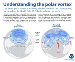
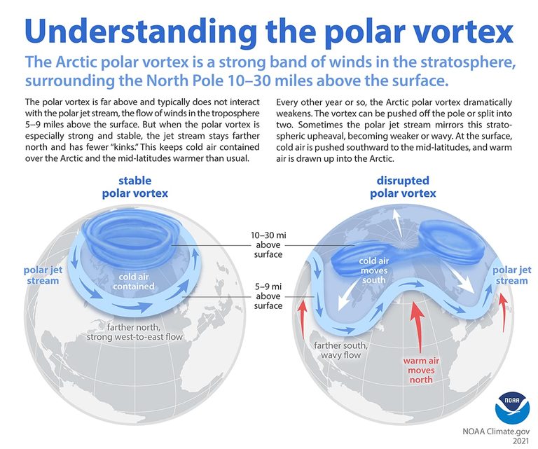
An SSW occurs when a surge of atmospheric energy moves upward into the stratosphere, rapidly raising temperatures there. This sudden heating can reverse the usual westerly wind flow around the polar vortex to an easterly direction, weakening the vortex’s ability to contain frigid Arctic air at the North Pole.
How the vortex change could affect Toledo
When the vortex is strong, it keeps the coldest air locked over the Arctic. A weakened vortex can split or expand, allowing the jet stream to dip farther south. For Toledo, that means the potential for colder air masses to reach the Ohio Valley in the coming weeks.
Experts note that the weather impacts of an SSW typically appear one to four weeks after the event. With Thanksgiving only a few weeks away, residents may see a shift from the current above‑normal temperatures toward a cooler pattern as the jet stream adjusts.
Current temperature outlook
Despite the vortex weakening, the National Weather Service’s 8‑ to 14‑day outlook still shows a strong probability of above‑normal temperatures through the Thanksgiving weekend, driven by a robust El Niño phase that usually brings warmth to the Ohio Valley.
However, forecasters caution that the combination of an El Niño‑induced warm trend and a disrupted polar vortex creates a “weather tug‑of‑war.” While the short‑term outlook remains warm, a later cold snap cannot be ruled out, especially if the jet stream shifts southward as the SSW’s effects materialize.
Historical context
Major SSW events have been recorded in November only a handful of times. Notable past occurrences include November 1958 and November 1968, both of which preceded colder spells in the central United States. The current event joins that short list, underscoring its rarity and potential significance for the coming weeks.
What residents can do
Weather‑aware citizens should keep an eye on local forecasts, especially as the holiday travel period approaches. Preparing for a possible temperature swing—by checking heating systems, stocking appropriate clothing, and staying informed about road conditions—can help mitigate any sudden changes.
Local authorities will continue to monitor the situation and provide updates through the National Weather Service and regional media outlets. For the most accurate, up‑to‑date information, tune in to local news stations, follow the National Weather Service’s social channels, or visit their website.
Looking ahead
As the SSW’s influence unfolds, meteorologists will refine their models to better predict when—and how strongly—the jet stream may dip. While the immediate outlook remains warm, the potential for a cooler spell later this month serves as a reminder that winter weather can be unpredictable, especially when the polar vortex is in flux.
For now, Toledo residents can enjoy the milder temperatures while staying prepared for any sudden changes that may arrive as the season progresses.
Original reporting: 13abc WTVG Toledo (news) — read the source article.