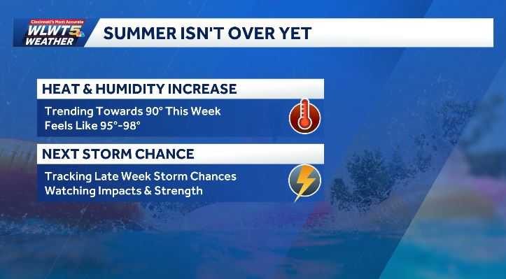
Residents of Cincinnati and the surrounding Tri‑State area should prepare for a classic summer heat wave this week. Monday morning started mild, with temperatures in the upper 60s to lower 70s, but the forecast shows a rapid climb as the sun intensifies.
Daily highs and heat index
High temperatures will reach the low 90s from Tuesday through Friday. While the actual temperature may feel comfortable, the increasing humidity will push the heat index into the mid‑90s, making it feel hotter than the thermometer reads. Overnight lows will remain mild, staying in the 70s, providing some relief for those who need to rest.
Humidity and comfort levels
Humidity levels are expected to rise steadily throughout the day, especially in the afternoon. This added moisture in the air will make the heat feel more oppressive, so residents are encouraged to stay hydrated, limit outdoor exertion during peak heat hours, and seek shade or air‑conditioned spaces when possible.
Potential for storms
While the week will be dominated by sunshine and heat, the forecast does indicate a growing chance of scattered thunderstorms later in the week, particularly by Thursday. These storms are expected to be isolated and should not significantly disrupt travel, but drivers are advised to stay alert for sudden downpours and possible brief lightning activity.
What to do
Local families can protect themselves by keeping water bottles handy, wearing light‑colored clothing, and using fans or air conditioning to stay cool. Parents should monitor children for signs of heat‑related illness, especially during outdoor activities. Outdoor events and school activities may need to be adjusted to avoid the hottest parts of the day.
For real‑time updates, residents can check the WLWT weather page or follow WLWT on social media platforms such as Facebook, Twitter, and Instagram. Staying informed will help the community navigate the heat safely and enjoy the sunny days ahead.
Original reporting: WLWT Cincinnati — read the source article.