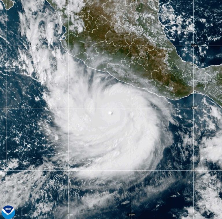
Mexico’s Pacific coast is on high alert as Hurricane Polo intensifies into a Category 5 cyclone, the strongest storm of the season. The National Hurricane Center (NHC) reported maximum sustained winds of 180 mph (290 kph) after a NOAA Hurricane Hunter aircraft flew into the storm.
Storm details and forecast
Polo is currently centered about 210 miles south of Zihuatanejo and is moving slowly west‑northwestward. The NHC expects the system to remain offshore for the next several days, though heavy rain could still affect coastal communities.
Experts note that Polo’s rapid strengthening is “truly remarkable,” with the storm reaching wind speeds comparable to only a few Pacific hurricanes in recent decades, such as Hurricane Patricia in 2015, which peaked at 215 mph.
Local impacts and safety measures
Mexican authorities have taken precautionary steps. President Claudia Sheinbaum told reporters that experts believe a direct landfall is unlikely, but the government’s navy has closed ports in Guerrero and Michoacán as a safety measure. Schools in affected areas were temporarily suspended on Tuesday.
The U.S. Embassy in Mexico issued a weather alert urging citizens to avoid beaches, stay away from the water and follow local warnings. The statement warned that even without a landfall, heavy rain could cause life‑threatening flooding and mudslides, while hazardous ocean conditions could produce deadly rip currents and rogue waves.
Rainfall and wind expectations
Forecasters predict 3‑6 inches (8‑15 cm) of rain for Guerrero and Michoacán, with smaller amounts possible for coastal parts of Oaxaca, Colima and Jalisco. Strong winds and rough surf are also expected, prompting fishermen and coastal residents to secure vessels and heed evacuation advisories.
Scientific perspective
Colorado State University research scientist Philip Klotzbach linked Polo’s rapid intensification to the ongoing El Niño event, which has warmed Pacific waters and altered wind patterns—conditions that fuel powerful hurricanes. “There are all the ingredients that hurricanes need to get really strong really fast,” he said.
The storm revives memories of Hurricane Otis in 2023, which devastated Acapulco after a sudden intensification left residents with little time to prepare.
Other tropical activity
While Polo dominates the Pacific, Tropical Storm Odalys remains far from land and is expected to become a hurricane later Tuesday, with maximum sustained winds of 65 mph. In the Atlantic, Tropical Storm Fay weakened to a tropical depression, with winds down to 35 mph, and is expected to become a remnant low.
Despite a quiet start to the Atlantic season, this year’s strong El Niño has suppressed early hurricane formation, setting a record for the longest start to a season without an Atlantic hurricane.
Original reporting: WESH Orlando — read the source article.