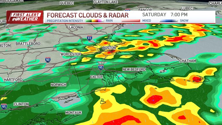
Residents of Greater Boston should prepare for a prolonged nor’easter that will dominate the weekend weather. The low‑pressure system is expected to linger south of New England, slowly shifting toward the New Jersey coast early next week, keeping rain and wind in the forecast.
Rainfall
Saturday will see periods of rain with intermittent lulls. Heavier bands will return like a pinwheel around the low, producing up to two to four inches of rain overall, with isolated amounts reaching five inches. Rain will continue into Monday, though intensity will lessen, and a few early‑morning showers may linger into Tuesday.
Wind
Strong northeast winds are forecast, with gusts of 50‑60 mph along the coast and 40‑50 mph inland. These winds could bring down trees and power lines. Residents are urged to secure outdoor items, including Halloween decorations, to prevent damage.
Coastal flooding
High tides combined with a full moon will raise water levels, creating foot‑level inundation in low‑lying areas and tidal waterways. Boston Harbor’s high tide on Saturday is at 11:34 a.m. and 11:54 p.m.; on Sunday it peaks at 12:12 p.m. Expect splash‑over in typical flood‑prone spots and stay away from water’s edge – remember, turn around, don’t drown.
Temperatures
High temperatures will remain in the lower 60s throughout the weekend, with a modest warm‑up to the low 70s by Wednesday as the system moves away.
Alerts and safety
Multiple weather alerts are active, including coastal flood warnings, high wind warnings, wind advisories, coastal flood advisories, and high surf advisories. Check local sources for updates and follow any evacuation or safety instructions.
The National Weather Service notes that nor’easters are most common in winter, making this September event unusual. Residents should stay informed and take precautions to protect property and personal safety.
Original reporting: NBC10 Boston — read the source article.