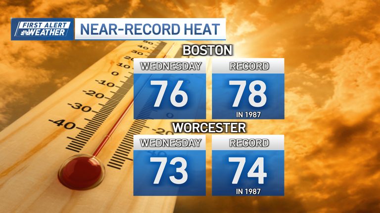
Residents of Boston and Worcester should prepare for an atypically warm start to November. Meteorologists predict that the region will experience daily highs in the low 70s, a temperature range more common in late summer than early fall.
What to expect this week
Today, despite a cloudier sky than yesterday, temperatures will still climb into the low 70s across most locations. Tomorrow’s peak warmth will be aided by a mild start in the upper 50s, allowing the mercury to rise toward a near‑record level for early November.
Both Boston and Worcester are in line for possible record highs, with sunshine dominating the day and breezes picking up slightly in the afternoon. While fire danger is not expected to become a primary concern, the dry conditions could allow any brush fires that do start to spread quickly.
Mid‑week outlook
Temperatures are expected to remain in the 70‑degree range through Friday, providing a pleasant, if unusual, extension of summer‑like weather. A slow‑moving weather system will bring showers Thursday night, leading to wet conditions on Friday and into at least part of Saturday.
By Sunday, the warm spell will subside, and temperatures will return to typical November levels. The jet stream is forecast to shift next week, ushering colder air into New England and dropping temperatures back into the low 50s by mid‑week.
Why this matters
If the region can sustain 70‑degree temperatures for five consecutive days, it would mark the first time such a streak has been recorded in Boston’s documented history. Residents can enjoy outdoor activities longer than usual, but should also stay alert for the possibility of rapid fire spread in any dry brush areas.
Overall, the community can look forward to a brief but welcome extension of warm weather before the season’s cooler patterns re‑establish themselves.
Original reporting: NBC10 Boston — read the source article.