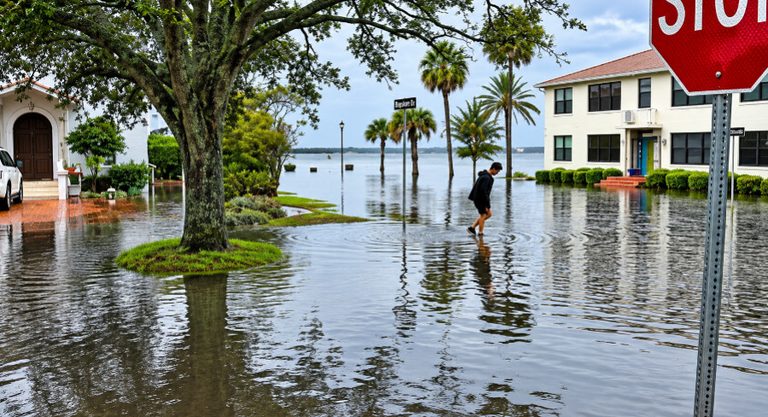
Florida’s Atlantic coast remains under water after the St. Johns River near Cocoa surged to 18.75 feet on Saturday, eclipsing the 1953 record of 17.55 feet. The river now sits above the major flood stage of 17 feet, and forecasters expect it could crest near 18.8 feet.
Record‑breaking water levels and ongoing rain
U.S. Geological Survey gauge readings confirmed the historic rise, while the National Weather Service warned that even without additional rain the river will stay high for an extended period. “Regardless of any additional rainfall, we are expecting these river floods to continue for an extended period of time,” meteorologist Melissa Watson said.
Earlier in the week, parts of Florida’s east coast recorded more than 17 inches of rain, making November the wettest on record for several communities. The saturated ground is slowing drainage, especially because the St. Johns River flows northward with a very gradual drop in elevation.
Impact on local roads and neighborhoods
Emergency crews have been using airboats and foot patrols to reach submerged neighborhoods in Brevard and Volusia counties. Dozens of high‑water rescues have been conducted, and road closures affect State Road 50, State Road 520 and State Road 46. Local officials in Rockledge and Palm Bay have issued evacuation orders or urged residents in low‑lying areas to prepare to leave.
Residents are urged to monitor updated river gauge readings from the National Weather Service and follow guidance from county emergency‑management offices.
Coastal hazards remain
Offshore conditions are still dangerous. The National Weather Service warned beachgoers to stay out of the water because of rough surf and strong rip currents, and issued marine warnings for thunderstorms capable of producing waterspouts.
The combination of record‑setting river levels, lingering showers and hazardous coastal conditions underscores the need for continued vigilance across the region.
Original reporting: Tampa Free Press — read the source article.