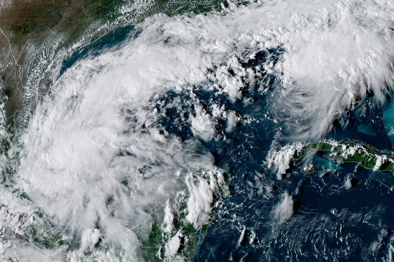
Early Wednesday, the National Hurricane Center in Miami reported that Tropical Storm Isaias has organized in the warm waters off eastern Mexico. At the time of observation the system was about 285 miles west of Progreso, Mexico, and roughly 580 miles southwest of the Mississippi River’s mouth. It was moving east‑northeast at eight miles per hour with maximum sustained winds of 40 miles per hour.
Forecast calls for rapid strengthening
Forecasters expect Isaias to gain strength quickly as it tracks toward the United States Gulf Coast. Model guidance shows the storm could become the first hurricane of the Atlantic season before making landfall later this week. The center’s latest projections place the storm’s eye somewhere between eastern Louisiana and the western Florida Panhandle.
Residents urged to prepare
“There is an increasing risk of dangerous wind and storm surge impacts along portions of the northern Gulf Coast,” the hurricane center warned. Officials in Louisiana, Mississippi, Alabama, and Florida are urging residents to review their hurricane plans, secure property, and stay informed of the latest forecasts. Emergency management agencies recommend having an evacuation route, a supply kit with water, non‑perishable food, flashlights, batteries, and a means of communication.
Heavy rain expected across the Southeast
In addition to wind and surge, Isaias is expected to bring heavy rain to much of the Gulf Coast and the broader southeastern United States through Friday and into the weekend. Flood‑prone areas should monitor river levels and be prepared for possible flash‑flooding.
Season context
The Atlantic hurricane season has been unusually quiet so far, a pattern attributed to a strong El Niño that suppresses storm formation over the Atlantic. Meanwhile, the Pacific basin has seen above‑average activity, underscoring the complex interplay of global weather patterns.
What to watch
Key indicators to follow include updates from the National Hurricane Center, local National Weather Service offices, and state emergency management alerts. Residents should keep an eye on the storm’s projected path, wind speed forecasts, and any official evacuation orders that may be issued as the system approaches.
By staying prepared and heeding official guidance, Gulf Coast communities can mitigate the potential impacts of what could become a significant hurricane later this week.
Original reporting: KTBS 3 (Shreveport) — read the source article.