Residents of the New York‑New Jersey‑Connecticut region should prepare for a wet weekend as a coastal low‑pressure system moves northward along the Atlantic seaboard. After a pleasant spell of warm November weather, high pressure will shift east, opening the door for the storm to affect the area beginning Saturday afternoon.
Rain and wind expected Sunday
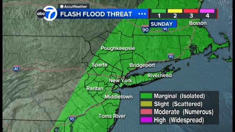
Saturday will remain largely dry, though cloud cover will increase in the afternoon. Light showers are likely to begin Sunday afternoon as the system lifts northward. The heaviest rain is forecast for Sunday evening, with a general accumulation of 1‑2 inches across the region and the potential for higher totals on Long Island, depending on the exact track.
Winds could gust over 30 mph along the coast, bringing the possibility of minor coastal flooding in low‑lying areas. Residents in western suburbs may see a sharp cutoff in rainfall totals, with significantly less rain than coastal locations.
Travel conditions improve by Monday
The system is expected to move quickly east of Long Island by Monday, allowing travel conditions to improve. This should set the stage for a drier stretch of weather at the start of next week, easing concerns for commuters and weekend travelers.
Thanksgiving travel outlook
Attention then turns to the Thanksgiving holiday travel period. Forecasts show an increased chance of rain for the Thanksgiving Day Parade, and another coastal storm could affect the region the following weekend. Residents are encouraged to stay tuned to local forecasts and plan travel accordingly.
For the latest updates, follow Eyewitness News and consult AccuWeather’s detailed forecasts as the situation evolves.
Original reporting: Brookhaven News – ABC7 New York — read the source article.