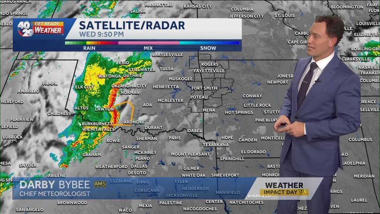
Chief Meteorologist Darby Bybee of 40/29 News is alerting residents of Northwest Arkansas and the River Valley that a line of intense storms is set to roll across the region early Thursday morning. The system is expected to arrive after 4 a.m., with the greatest risk of severe weather focused on the NWA area, though portions of the River Valley could also see impacts.
What to expect
The primary hazard highlighted by Bybee is straight‑line wind. These winds can reach damaging speeds and pose a threat to vehicles, trees, power lines, and outdoor structures. Because the storms are forecast to develop before most commuters hit the road, the timing is especially concerning for anyone traveling to work or school between 5 a.m. and 8 a.m.
Live coverage and resources
Viewers can follow the evolving situation on 40/29 Sunrise from 4:30 a.m. to 7 a.m., when meteorologist Laura Huckabee will provide live updates and safety tips. A second live segment will air on the CW from 7 a.m. to 8 a.m., offering a final briefing before the bulk of the morning rush.
For those who prefer digital tools, the 40/29 website features a seven‑day forecast for both Northwest Arkansas and the River Valley, an interactive radar map, and live sky‑cam feeds that show real‑time conditions across the region.
How to stay safe
Residents are encouraged to take the following precautions:
- Secure outdoor items such as lawn furniture, grills, and trash cans that could become projectiles in strong winds.
- Allow extra travel time and stay tuned to local weather updates before heading out.
- If you hear a sudden, loud noise that sounds like a thunderclap but no lightning is visible, it may be a downburst – pull over safely and wait for the storm to pass.
- Consider keeping a battery‑powered flashlight and a basic emergency kit in your vehicle.
About the 40/29 Get Ready Weather Team
The Get Ready Weather Team, led by Chief Meteorologist Darby Bybee, includes meteorologists Laura Huckabee, Drake Foley, and Cole Makos. Their mission is to provide timely, accurate weather information to keep the community safe during severe weather events.
For continuous updates, download the free 40/29 News app, personalize alerts for your area, and follow the station on YouTube for the latest weather and news coverage.
Looking ahead
While Thursday’s early‑morning storms are the immediate concern, forecasters will continue to monitor the broader weather pattern for any lingering effects later in the day. Residents should remain vigilant and stay informed through official channels.
Original reporting: 40/29 News KHBS Fort Smith (local) — read the source article.