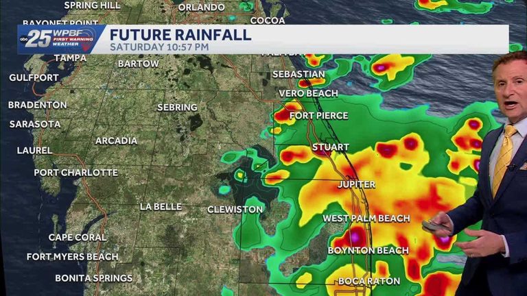
South Florida is set for a pleasant yet breezy weekend. Warm daytime highs will climb into the low‑to‑mid 80s across Palm Beach County, the Treasure Coast and inland areas such as Okeechobee County. A steady north‑northeast wind will keep the air moving, bringing gusts that may feel stronger along the shoreline.
Wind and temperature details
After a few calmer days, the region will see a return of gusty winds from the north‑northeast. While daytime temperatures remain comfortably warm, the wind will provide a cooling effect, especially for those spending time on the beach or outdoors. Expect wind speeds to increase on Saturday and Sunday, with gusts that could reach 15‑20 mph in exposed coastal spots.
Rip‑current advisory
The National Weather Service continues to issue a high risk for rip currents along the Atlantic coast. Swimmers and surfers should remain vigilant, heed local lifeguard warnings, and avoid entering the water during periods of stronger onshore flow. The combination of wind‑driven waves and shifting sandbars can create hazardous conditions, particularly on the Treasure Coast and in Palm Beach County.
Chance of showers
Scattered showers are possible along the coast, especially on Saturday afternoon. These brief downpours will be most likely on the Treasure Coast, where the chance of rain is slightly higher than in Palm Beach County. Showers are expected to be short‑lived, allowing plenty of sunshine to return between rain periods.
Overnight and Sunday outlook
Tonight, a few coastal showers may develop, bringing a cooling effect after sunset. Low temperatures will range from the low‑to‑mid 60s in Okeechobee County and the northern Treasure Coast to the mid‑to‑upper 60s further south. Winds will ease to a light breeze from the north‑northeast, making for comfortable evening conditions.
On Sunday, the pattern remains similar. Warm highs will persist, and the wind will stay breezy but less intense than Saturday. The rip‑current risk will continue, so beachgoers should stay alert. Any remaining showers are expected to dissipate by early afternoon, leaving clear skies for the remainder of the day.
Safety reminders
Local authorities advise residents to monitor weather updates, especially if planning water activities. Keep an eye on local news outlets and the National Weather Service for any changes to the wind or rip‑current advisories. Parents should remind children of beach safety rules, and families are encouraged to enjoy the warm weather while staying mindful of the wind and water conditions.
Original reporting: WPBF (Treasure Coast / Hearst) — read the source article.