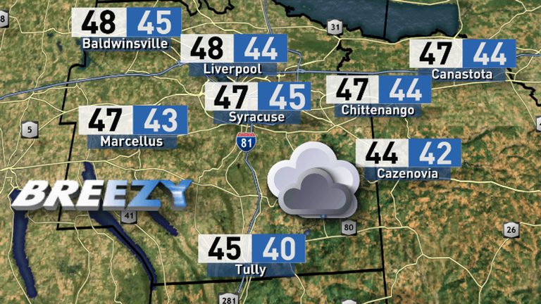
Saturday’s weather in Syracuse is marked by overcast skies, scattered showers, and cooler temperatures after a stretch of record‑breaking warmth last week. The National Weather Service indicates that today’s high will sit below the seasonal average, making for a gloomy start to the weekend.
Current Conditions and Tonight’s Outlook
Morning observations show a low‑pressure system lingering over the Great Lakes, bringing wrap‑around and lake‑effect rain showers that will continue into the early hours of Sunday. While the precipitation is expected to be steady, forecasters do not anticipate any severe weather threats such as strong winds or flooding.
Rainfall totals through Sunday evening are projected to remain modest for most of central New York, staying under half an inch. Isolated pockets may see up to one inch, but overall accumulation will be limited.
Looking Ahead: Unsettled Weather Through the Week
The next several days will feature an unsettled pattern, with multiple chances for additional rain showers and breezy conditions. Meteorologists note that temperatures will keep dropping, setting the stage for Syracuse’s first snowfall of the season, likely arriving on Friday.
Residents are encouraged to stay informed through local forecasts and to keep an eye on live radar updates, especially if traveling or planning outdoor activities.
Helpful Resources
For the most current forecast, radar imagery, and any weather‑related alerts, click here.
Original reporting: CNY Central WSTM (Sinclair) – local — read the source article.