Northern Oklahoma is bracing for severe weather risks, including strong winds and isolated storms, as Fourth of July celebrations align with potential evening storms. KOCO 5 Chief Meteorologist Damon Lane said temperatures are expected to reach the upper 90s and 100s on Saturday, with a low-end chance of isolated storms in the afternoon.
Saturday Severe Weather Threat
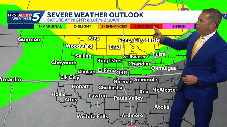
The severe weather window begins around sunset, coinciding with many fireworks shows, and could last well into early Sunday morning. The risk area spans from Denver to Washington, D.C., with northern Oklahoma caught in the middle.
Clusters of storms are expected to develop in the Oklahoma Panhandle and southern Kansas around sunset, with storms flaring up in northern Oklahoma in areas such as Buffalo, Alva, Helena, Wakita, Perry, Stillwater, and Cushing. These storms pose a strong wind threat.
Residents are advised to stay alert and monitor weather updates as they plan their holiday celebrations.
Original reporting: Oklahoma City News Feed (HLL/CB) — read the source article.


