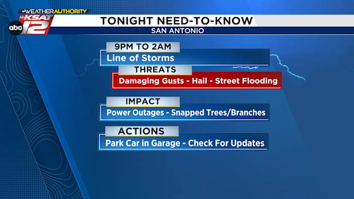
Storms moving through South-Central Texas are closing in on San Antonio tonight, bringing a shot of damaging winds, hail, and the real possibility of street flooding into the overnight hours and into the holiday weekend. This update walks through the timing, the threats, and practical steps to protect cars, power, and plans as additional rounds of storms roll through Thursday and into Saturday. Pay attention to forecasts from local meteorologists and have the KSAT Weather Authority App ready for alerts and live radar.
TONIGHT: A frontal line already in South-Central Texas is heading toward San Antonio and will be capable of producing strong, damaging wind gusts in a relatively short period of time. Some of the stronger cells could produce hail, and any training storms could dump heavy rain quickly. Expect the main line to push south of the immediate area by about 2 am, but pockets of heavy rain and gusty winds could linger longer.
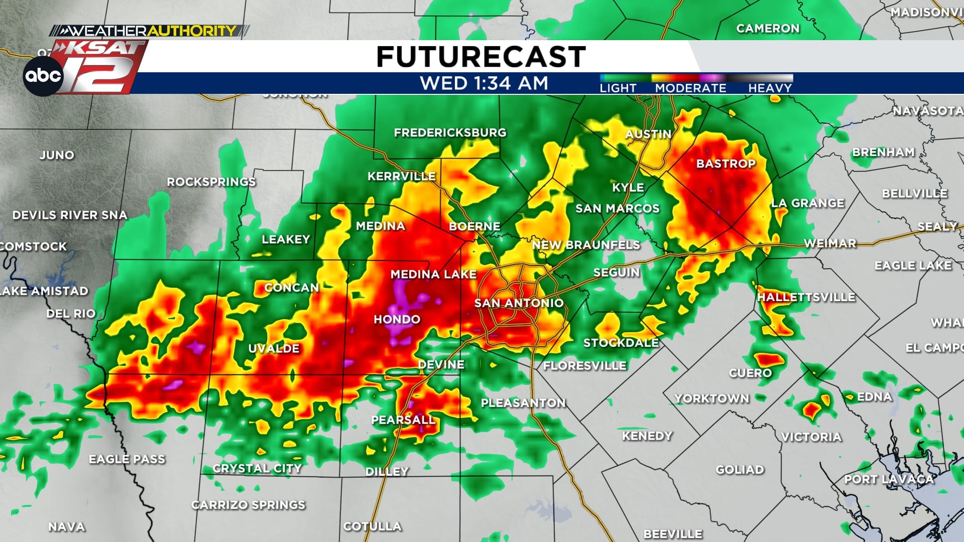
Rainfall totals in spots could reach 1 to 3 inches, and localized amounts higher than that are possible where storms stall or train over the same neighborhoods. With that kind of rain expected over a short period, street flooding is the primary concern for overnight travel and low-lying roads. Power outages and snapped branches are realistic impacts when you combine strong gusts and saturated soil around older trees.
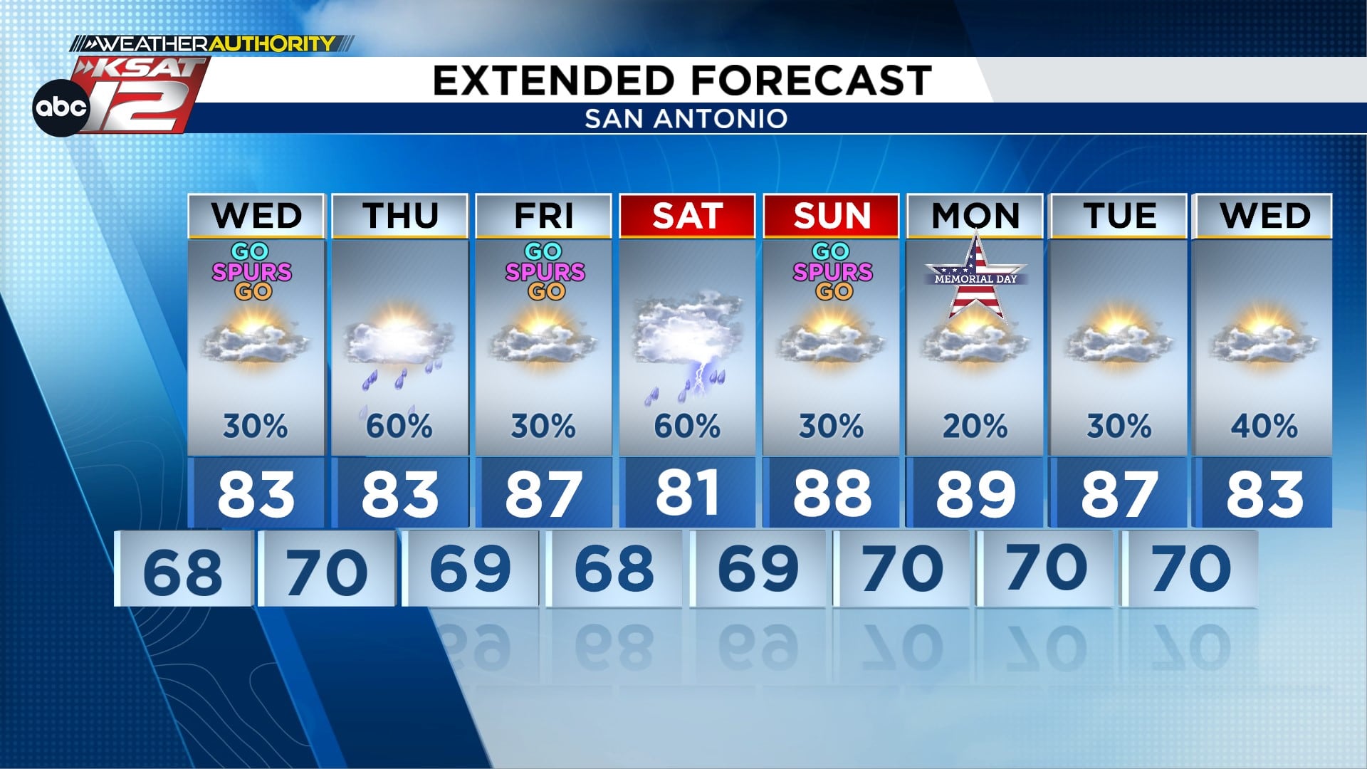
WEDNESDAY: After the overnight activity moves away, the first half of Wednesday should feel calmer and drier for most people. By afternoon heat and humidity will help destabilize the atmosphere, meaning isolated storms are possible, especially in the late afternoon and evening hours. There is also a decent chance another wave of storms could push north out of Mexico into the region Wednesday night into Thursday morning, and if that trend verifies street flooding will once again be the biggest threat.
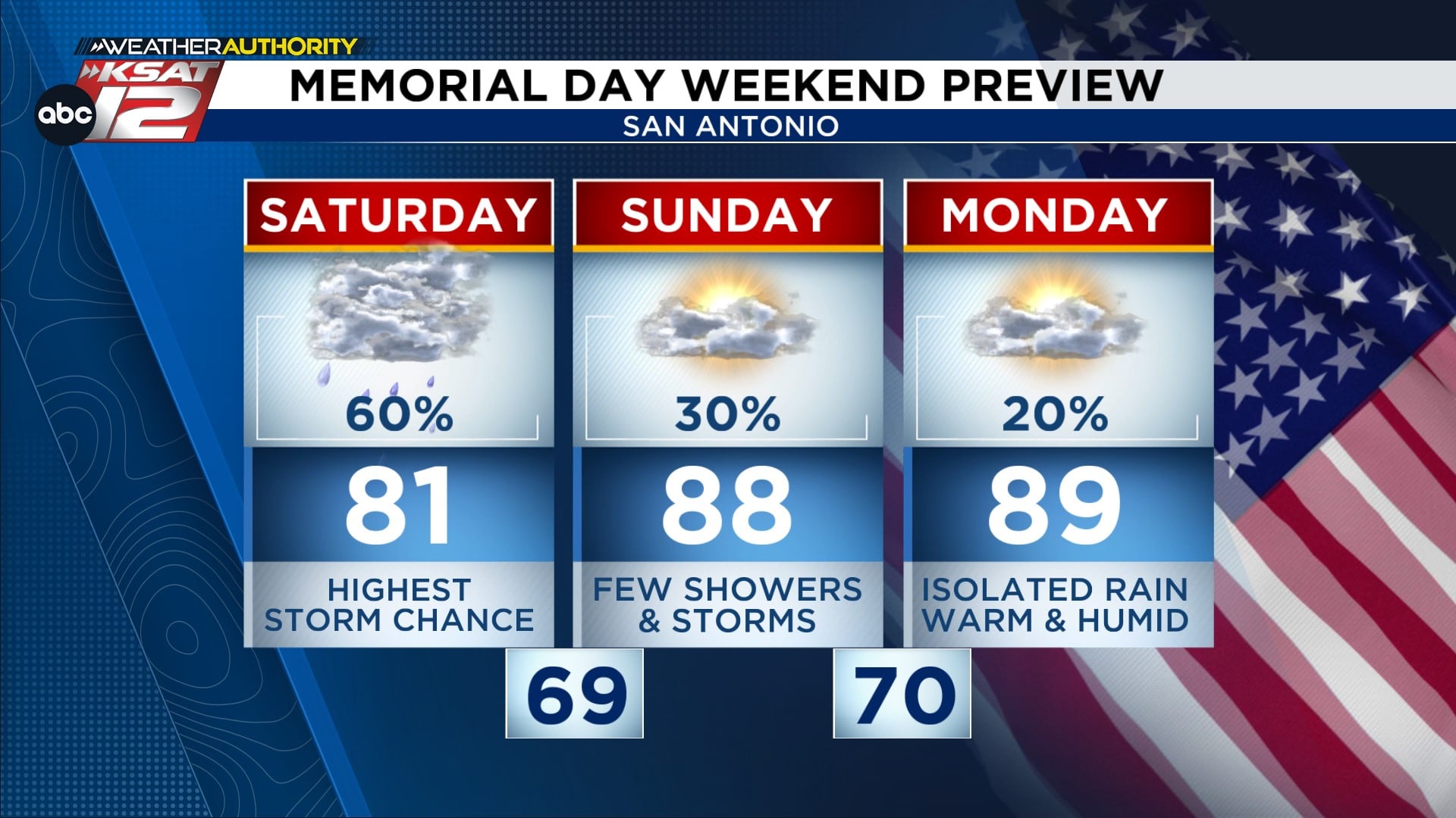
MEMORIAL DAY WEEKEND: The forecast keeps the threat of additional storm rounds in play through Saturday, so any travel or outdoor plans could be interrupted by heavy rain and gusty winds. Saturday currently looks most likely for the next significant round, which could lead to roadway flooding and scattered power outages across parts of the region. Sunday into Memorial Day itself trends toward fewer storms, but the picture will be refined as data comes in, so remain flexible with weekend plans.
Take a few practical steps now: park vehicles in a garage or away from trees when possible, secure outdoor items that could become projectiles in gusty winds, and charge phones and backup batteries in case of brief power interruptions. Keep an eye on low-water crossings and avoid driving through standing water; even shallow floodwater can sweep a vehicle off the road. Keep the KSAT Weather Authority App handy for push alerts and live radar so you can react fast if conditions worsen.
Local meteorologists will be monitoring the line as it approaches and will update timing and threat levels if storms intensify or slow down. Over the next few days the biggest items to watch are damaging winds, potential hail in stronger updrafts, and pockets of heavy rain that could produce street flooding. If you live in areas prone to flooding or near large trees, consider moving cars and checking emergency supplies now rather than waiting.
For quick reference, here are the main resources many locals use to stay informed:
- WATCH LIVE: Doppler Radar
- Hourly and 10-Day Forecast
- Download FREE KSAT Weather Authority App: Up-to-date forecast information and livestreams from local meteorologists
- KSAT Connect: Share your weather photos


