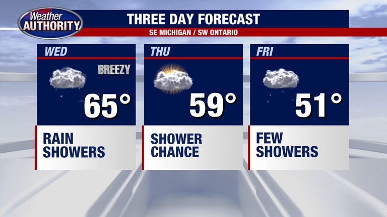
Metro Detroit will see a noticeable shift in the weather on Wednesday, with temperatures pulling back from the near‑record 75°F recorded yesterday. Forecasts call for rain to dominate the day, keeping highs comfortably in the 60‑degree range.
Wednesday’s rain pattern
Widespread rain is expected to arrive this morning and continue off and on through the afternoon. Most of the precipitation will be light, though pockets of moderate rain may develop at times. Total rainfall amounts are projected to stay modest, with most locations seeing around 0.25 inch or less.
What’s coming Thursday
A spotty shower is possible on Thursday, followed by scattered to widespread showers later in the day as the system moves eastward. Residents should keep an umbrella handy if they have outdoor plans.
Looking ahead to the weekend
Actual November weather is on its way. Friday and Saturday are expected to be just a touch below average temperatures, but the cooler air will feel markedly different from the recent warmth. Despite the cooler trend, temperatures will remain mild, staying near the 60‑degree mark.
Next week’s outlook
Temperatures are set to rebound early next week, warming back up to around 60°F, providing a more typical early‑winter feel for the region.
Drivers are advised to use caution on wet roads, especially during the morning commute, and to stay tuned to local forecasts for any updates.
Original reporting: Warren | FOX 2 Detroit — read the source article.