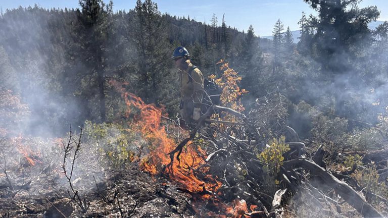
Plumas National Forest crews began a prescribed‑burn operation on Wednesday in the South Park area just north of Quincy, treating roughly 152 acres to reduce future wildfire risk. The effort starts near the Ridge and Bear Cub trails and moves westward toward the planned treatment boundary.
Trail access changes
To keep the public safe while the fire is under control, the South Park Trailhead (also known as the Barlow Trailhead), the Monument Trailhead, and several access points along Chandler Road are closed until the burn is complete. Hikers can still use the Spanish Trailhead, Spanish Traverse, Spanish Ridge, and the Cascades Trail from its own trailhead.
Smoke outlook
Officials expect smoke to be visible in Quincy, Indian Valley, along Chandler Road and Oakland Camp Road, and near Highway 70. While the smoke may cause short‑term visibility reductions on Chandler Road, Highway 70 and nearby forest roads, the Forest Service does not anticipate significant long‑term impacts for surrounding communities.
Smoke could settle into lower‑lying areas Wednesday evening, affecting Quincy, Keddie, and other canyon communities, with limited effects possible in Indian Valley. Residents who are sensitive to smoke are urged to monitor conditions and take precautions as needed.
Travel advisories
Drivers should expect increased firefighter traffic, especially on Chandler Road. The Forest Service asks motorists to avoid the road when possible, use alternate routes, or travel with extra caution. Those on Highway 70 near the ranger station and Chandler Road should watch for firefighting equipment entering and exiting the roadway, which may cause temporary slowdowns.
Who’s involved
The prescribed‑burn operation is a joint effort between Plumas National Forest personnel and Forest Service firefighters from across the region. Prescribed burns are a proven tool for reducing hazardous fuel loads, protecting homes and natural resources from uncontrolled wildfires.
What residents can do
People who are sensitive to smoke should stay informed through local weather updates and consider limiting outdoor activities during peak smoke periods. If you encounter closed trailheads, respect the closures and plan alternative routes for hiking or recreation.
For the latest information on fire conditions, road closures, and smoke advisories, visit the Plumas National Forest website or follow the agency’s social‑media channels.
Original reporting: 2news.com — read the source article.