Residents of Northwest Arkansas and the River Valley should be prepared for the possibility of isolated showers on Memorial Day. The region has experienced warm temperatures, with highs reaching the low to mid-80s over the weekend. While most areas remained dry, a few spotty showers developed in the eastern parts of the River Valley on Sunday.
Memorial Day Forecast
As we move into Memorial Day, patchy fog may develop in some areas during the morning hours. Temperatures are expected to remain warm, with highs in the low 80s in Northwest Arkansas and mid-80s in the River Valley. Partly cloudy skies will prevail, but there is a chance of additional scattered showers and possibly a rumble of thunder in the afternoon.
Most of the rain activity is expected to be concentrated in the River Valley, though some scattered showers may also occur in Northwest Arkansas. Despite the potential for rain, the majority of the area is likely to stay dry throughout the day.
Looking Ahead
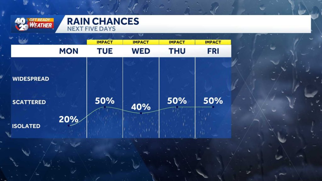
After Memorial Day, the forecast indicates a series of ‘Impact Days’ from Tuesday through Friday, with several rounds of showers and storms anticipated. Although the potential for severe weather is low, heavy rain is possible during this period.
The 40/29 Get Ready Weather Team, including Chief Meteorologist Darby Bybee and meteorologists Laura Huckabee, Drake Foley, and Cole Makos, will continue to monitor the weather closely. Residents are encouraged to stay informed by tuning into 40/29 News for the latest updates and downloading the 40/29 News app for personalized weather alerts.
Original reporting: 40/29 / KHBS (NW Arkansas) — read the source article.