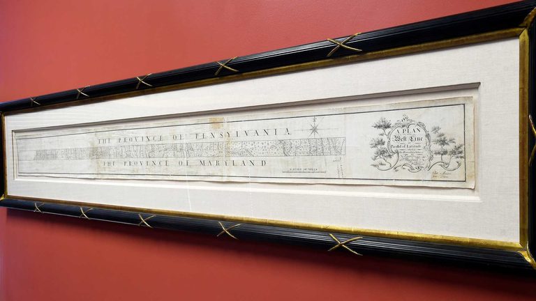
Forty‑five bidders competed for less than three minutes to acquire the original hand‑drawn map that established the Mason‑Dixon Line, the boundary that later symbolized the division between free and slave states in the United States. The auction, held both online and in person at Brunk Auctions in Asheville, North Carolina, closed at $950,000.
Background on the historic survey
The survey was commissioned in the 1760s to settle a border dispute between the colonies of Maryland and Pennsylvania. Completed in 1768 by English astronomers Charles Mason and Jeremiah Dixon, the map later served as a reference point for the 1820 Missouri Compromise and became synonymous with the sectional tensions that erupted into the Civil War.
Previous ownership and auction details
The late publisher Malcolm Forbes purchased the map in 1982 for $360,000, outbidding the Library of Congress. It changed hands again in 2002, selling for $556,000. This latest sale began with a $400,000 opening bid and concluded with a $950,000 final price, short of the $1.2 million high estimate.
Brunk Auctions Vice President Lauren Brunk expressed satisfaction with the result, noting, “It’s a very high price for a map.” She added that the buyer wishes to remain anonymous for now and that the map will be placed in a “good home.”
Where the map is now
A vertical section of the map that depicts the Delaware‑Maryland border is housed at Princeton University. The remainder of the document will now be in the possession of the undisclosed purchaser, who acquired a piece of American history that has shaped the nation’s political landscape.
The auction underscores the enduring interest in artifacts that illuminate the nation’s founding conflicts and the ongoing relevance of the Mason‑Dixon Line in discussions of American heritage.
Original reporting: WTAE (Hearst) – local — read the source article.