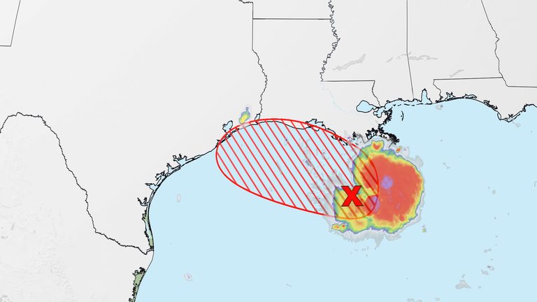
Since making landfall near the Texas‑Louisiana border on Tuesday afternoon, the system now known as Tropical Depression Edouard has unleashed torrential rain across southeast Texas. The National Weather Service in Houston predicts storm totals of three to seven inches from the upper Texas coast to east‑central Texas, with isolated spots potentially seeing as much as twelve inches.
Local impacts and emergency response
Houston’s Office of Emergency Management has mobilized high‑water rescue vehicles and begun lowering the water level in Lake Houston to create additional capacity for runoff. “We are taking every precaution to protect our neighborhoods and ensure swift rescue operations if needed,” said Ruth Tovar, the office’s spokesperson.
Flash‑flood warnings extend from Houston northward to College Station and even south of Dallas by Wednesday morning. Rainfall rates of two inches per hour or more are expected, a level sufficient to overwhelm road drainage systems and cause rapid flooding of low‑lying areas.
What residents should do
Officials urge residents to avoid driving through standing water, keep an eye on local alerts, and be prepared to move to higher ground if flash‑flood warnings are issued for their area. The Houston Police Department and local fire districts are on standby to assist motorists and homeowners who become stranded.
In southwestern Louisiana, communities can expect two to four inches of rain, while the storm’s remnants are forecast to dissipate over eastern Texas on Wednesday. Any lingering moisture may spark isolated thunderstorms on Thursday, though the overall flood threat should subside.
Seasonal context
Edouard is the fifth named system of the 2026 Atlantic hurricane season, which has been unusually quiet due to a strong El Niño that has increased wind shear across the tropical Atlantic. The season’s activity is running at just 11 % of the historical average as of August 30, according to the National Hurricane Center.
Previous storms this year—Dolly, Cristobal, Arthur and Bertha—have all been short‑lived, with the first hurricane of the season still three weeks behind schedule. While the El Niño has suppressed storm development, forecasters caution that windows of opportunity can still arise, and residents should remain vigilant throughout the peak month of September.
Looking ahead
State and local emergency managers will continue to monitor river levels and road conditions as the system weakens. Residents are encouraged to sign up for local alert systems, keep emergency kits stocked, and follow guidance from the Texas Division of Emergency Management.
For the latest updates, visit the National Weather Service’s Houston office website or follow the Houston Office of Emergency Management on social media.
Original reporting: KRDO (Colorado Springs metro) — read the source article.