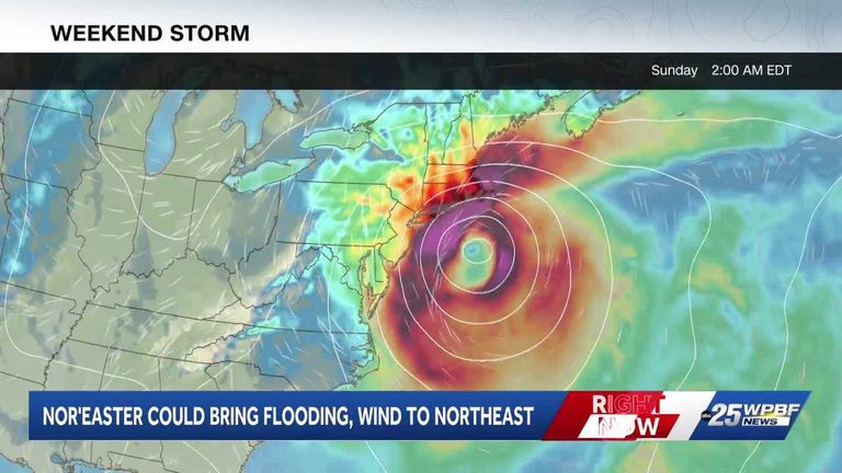
The first nor’easter of the 2026‑27 season is expected to affect the Northeastern United States this weekend. Meteorologists say the system is currently developing just off the coast of Virginia and will move northward along the shoreline over the next two days.
What residents can expect
Along the coastal stretch from the Mid‑Atlantic up through New England, forecasters are warning of sustained wind gusts between 40 and 60 mph. Those winds, combined with a surge of one to four feet, could produce localized flooding, especially in low‑lying areas and near waterfront properties.
Rainfall totals are projected to range from four to six inches, with the heaviest amounts likely to fall in the early afternoon hours on Saturday. The combination of heavy rain and strong on‑shore flow raises the risk of flash flooding in river valleys and urban drainage systems.
Why nor’easters form
Nor’easters are low‑pressure systems that draw their energy from the temperature contrast between cold Arctic air moving southward and the warm waters of the Gulf Stream. This clash of air masses creates the classic northeast‑to‑southwest wind pattern that gives the storm its name. Historically, these systems develop between September and April, making this early appearance noteworthy for the season.
Safety tips for families
Parents and homeowners should take a few precautionary steps before the storm arrives. Secure loose outdoor items, such as patio furniture and trash cans, to prevent them from becoming projectiles in high winds. If you live in a flood‑prone area, consider moving valuables to higher ground and reviewing your emergency kit.
Drivers are advised to allow extra travel time, avoid non‑essential trips during peak wind periods, and stay tuned to local traffic updates. Power outages are possible, so having flashlights, batteries, and a charged mobile device on hand is prudent.
Local response and resources
State and local emergency management agencies are monitoring the storm closely. The National Weather Service has issued a coastal flood advisory for several counties along the Atlantic seaboard. Residents can sign up for free alerts through local government websites or by following official social‑media channels.
In the event of severe flooding or wind damage, contact your county’s emergency services line. Shelters will be opened in affected municipalities for those who need temporary housing.
Looking ahead
While this nor’easter is expected to weaken as it moves inland, the lingering moisture could keep rain chances elevated into early next week. Weather officials will continue to update forecasts as the system evolves, so staying informed through reliable sources is essential.
Overall, the storm presents a reminder of the power of nature and the importance of community preparedness. By taking sensible precautions and heeding official guidance, families can protect their homes and loved ones while the season’s first nor’easter passes through.
Original reporting: WPBF (Treasure Coast / Hearst) — read the source article.