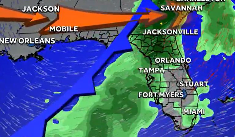
Florida residents should prepare for the state’s first El Niño‑induced weather event of the season, a storm system that is expected to move across the southeast United States around November 4‑5, according to First Warning Chief Meteorologist Tony Mainolfi.
What is El Niño and why it matters for Florida
El Niño is a natural climate cycle that occurs when sea‑surface temperatures in the tropical Pacific rise enough to alter global wind patterns. Those shifts ripple through the atmosphere, influencing weather far beyond the Pacific basin.
For Florida, El Niño typically brings cooler temperatures and above‑average rainfall during the dry season months of November through April. The increased storminess often translates into a wetter winter, which can be a welcome relief after the hot, dry summer months.
Forecast details for the upcoming system
Forecasters say the developing low‑pressure area will begin to affect the southeast U.S. early next week, with the strongest impacts felt on November 4 and 5. Residents can expect a mix of rain showers, gusty winds, and a modest drop in temperature across the peninsula.
While the system is not expected to produce a tropical storm or hurricane, the added moisture could lead to localized flooding in low‑lying areas, especially where drainage is already strained. Homeowners near rivers, canals, and coastal inlets are advised to monitor local flood‑watch advisories.
How the storm fits into the broader El Niño pattern
Historically, strong El Niño events have suppressed hurricane activity in the Caribbean and tropical Atlantic, while increasing storm activity in the central and eastern Pacific. That shift often results in fewer tropical storms and hurricanes threatening the Gulf Coast and Atlantic seaboard, but it can also mean more tropical threats to Hawaii and the Southwest United States.
In the United States, the most notable impacts of El Niño occur during the winter months. A warmer‑than‑average winter is common from the northern states to western Canada and Alaska, while the southern tier of the country—particularly Florida—tends to see cooler, wetter conditions as a strengthened jet stream steers more storms across the region.
What Floridians can do now
Local emergency management agencies recommend that residents:
- Check that gutters, downspouts, and drainage systems are clear of debris.
- Secure outdoor items that could become projectiles in gusty winds.
- Review flood‑watch and flood‑warning alerts for their specific county.
- Keep an emergency kit stocked with water, non‑perishable food, flashlights, and a battery‑powered radio.
For those with agricultural interests, the added rainfall may benefit crops that rely on winter moisture, but it also underscores the need for careful soil management to prevent erosion.
Looking ahead
The National Weather Service continues to monitor the developing system and will issue updates as the event approaches. Residents should stay tuned to local news outlets, weather apps, and the NWS website for the latest forecasts and any potential advisories.
While El Niño can bring challenges, it also offers an opportunity for Florida to experience the cooler, wetter winter conditions that many residents appreciate after the scorching summer. By staying informed and prepared, Floridians can navigate the upcoming storm with confidence.
Original reporting: WESH Orlando — read the source article.