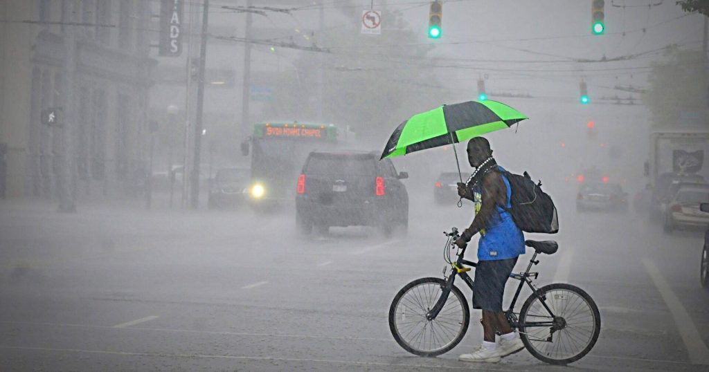
Forecasts for local communities point to a decidedly wet day, with frequent showers and a real chance of thunderstorms, especially in the early afternoon. The National Weather Service expects pockets of heavy rainfall that could produce localized flooding, cooler air moving in behind storms, and sustained winds near 8 to 11 mph for much of the region.
The morning will likely start with scattered light rain, but conditions will crank up by midday as instability builds. Showers are expected to become more numerous and stronger heading into the early afternoon, so outdoor plans between late morning and midafternoon face the highest risk of disruption. Timing will vary block to block, so keep an eye on current radar to know when your neighborhood gets hit.
Thunderstorms are possible and could bring brief but intense bursts of rain that drop a lot of water in a short time. That kind of quick downpour is the main driver of localized flooding on streets and in low-lying yards. Even if a storm passes quickly, water can pool on pavement and overwhelm older drainage systems, creating hazardous driving conditions and sudden standing water near intersections.
Expect temperatures to dip as showers and storms move through, turning what might feel like a warm morning into a noticeably cooler afternoon. Wind will be a steady companion at roughly 8 to 11 mph, with occasional gusts higher inside stronger thunderstorms. Those winds will make the cool air feel sharper and can cause umbrellas and lighter outdoor items to blow around if not secured.
Commuters should plan for slower travel and the potential for brief road closures where water collects. Drive with headlights on, reduce speed, and avoid sudden lane changes when visibility drops or water is pooling. If you have a midday appointment or outdoor event, consider moving it indoors or delaying start times until the late afternoon when conditions are likely to improve.
Lightning is a real hazard in any thunderstorm, so follow the rule of thumb: if you can hear thunder, you are close enough to be struck by lightning. That means seek shelter in a sturdy building or a hard-topped vehicle immediately and avoid open fields, tall trees, and metal objects. Outdoor workers and recreational groups should have a quick plan to get people under cover and off elevated or exposed ground.
Homeowners should check that gutters and downspouts are clear to help channel heavy rainfall away from foundations and basements. Move lightweight patio furniture and secure trash bins that could be toppled by gusts, and avoid standing water near electrical equipment. If you live in a known flood-prone pocket, have sandbags or other barriers ready and consider shifting vehicles to higher ground before afternoon storms arrive.
Businesses with outdoor operations need to be ready to pause work and protect equipment. Construction sites should tie down materials and cover sensitive gear, while event organizers should set contingency plans for moving people to sheltered areas. Small delays now can prevent bigger headaches later if a fast-moving thunderstorm hits and crews are forced to scramble in wet, windy conditions.
The best way to stay ahead of this unsettled pattern is to use real-time radar and alert services from reliable providers like the National Weather Service and local emergency management. Set push alerts for thunderstorm warnings and flash flood advisories, and check radar imagery before leaving for appointments. With storms likely focused in the early afternoon, a little timing awareness will let you avoid the worst of the wet weather and keep travel and plans safer.


