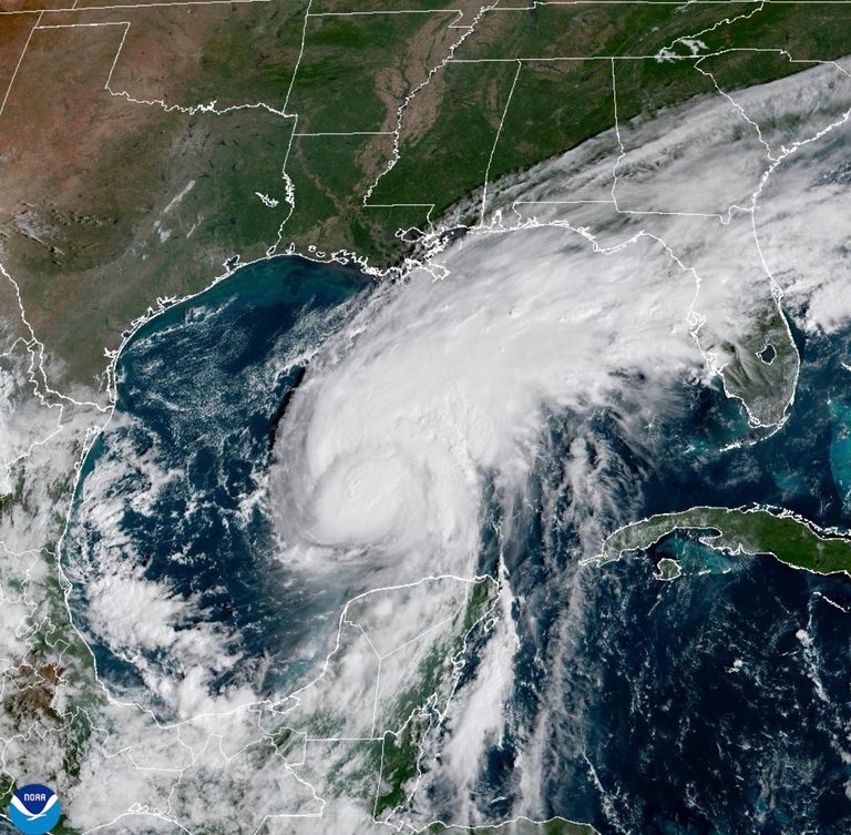
Colorado State University hurricane expert Phil Klotzbach explained that the 2026 Atlantic hurricane season has become a contest between wind shear from a powerful El Niño and the overall favorable conditions that usually fuel storms. El Niño’s warm‑phase Pacific winds are generating strong wind shear that can tear storms apart, while the Gulf of Mexico’s waters are about 2.7 °F (1.5 °C) above normal, providing ample heat and moisture.
How wind shear works
Wind shear pushes the tops and middle of a tropical cyclone sideways, preventing the formation of a symmetric eyewall. Without a complete circular eyewall, a storm cannot fully intensify. Klotzbach and University at Albany researcher Kristen Corbosiero noted that this shear has “decapitated” many potential storms this season.
Warm Gulf waters add fuel
Despite the shear, the Gulf’s 86 °F (30 °C) waters are 100‑to‑500‑times more likely to be unusually hot because of climate‑related warming from the burning of coal, oil and gas, according to Climate Central vice‑president Kristina Dahl. Warm water and high moisture can still boost a storm when shear eases.
Isaias’ recent intensification
Isaias surged from 40 mph to 80 mph (64 kph to 129 kph) in a single day, becoming the first Atlantic hurricane of the season since 1914, Klotzbach said. He added that the storm appears to be losing its tilt and may briefly reach 111 mph (178 kph) winds, potentially attaining major‑hurricane status, though that would likely be short‑lived.
What’s next for coastal residents
Forecasters expect wind shear to increase from moderate levels of about 20 mph (32 kph) to 52 mph (84 kph) as Isaias approaches the Gulf Coast, which should curb further strengthening. Klotzbach predicts the storm will make landfall as a strong Category 1 or weak Category 2 hurricane, still capable of causing significant damage.
Sea‑level rise, driven by long‑term climate warming, adds to the threat. Dahl warned that rising seas mean higher storm surge, with roughly six and a half inches of sea‑level increase over the past century in the region. The National Hurricane Center has labeled the expected surge as “life‑threatening.”
In addition to wind and surge, a warmer atmosphere means the storm can hold more rain, raising the risk of urban, river and flash flooding across the Southeast, according to Dahl. Residents are urged to stay informed and heed local emergency guidance as the storm approaches.
Original reporting: Alexandria, VA News – WTOP News — read the source article.