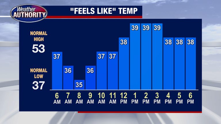
Metro Detroit is under a cold snap today, with afternoon highs failing to reach the 50°F mark. A steady breeze is keeping most areas in the 30s, making it feel even colder for commuters and families heading outdoors.
Today’s Conditions
While rain will not dominate the day, a stray shower could develop intermittently, especially across the eastern shore of the Thumb region in St. Clair and Sanilac counties. The coverage is expected to be light, and any precipitation should be brief, allowing most of the day to remain dry.
Evening Outlook
Later this evening, a few heavier bands of rain are forecast to move into the eastern Thumb, but the overall intensity will be limited. Residents in those counties should keep an umbrella handy, though the rain is not expected to cause significant disruptions.
Weekend Forecast
The coming weekend will stay cooler, with temperatures remaining below typical seasonal averages. By Sunday afternoon, however, a modest warm‑up is expected, pushing highs toward the 60°F range early next week. This gradual rise should bring some relief after a few days of biting cold.
What to Expect Next Week
Looking ahead, the forecast shows a continued trend toward milder weather early next week, with daytime temperatures edging into the low 60s. Residents can anticipate a more comfortable climate for outdoor activities and travel as the week progresses.
For those planning to spend time outside, dressing in layers and staying aware of changing conditions will help make the most of the cooler days ahead. Keep an eye on local updates for any sudden changes in precipitation, especially in the Thumb area.
Original reporting: Warren | FOX 2 Detroit — read the source article.