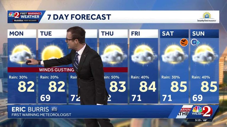
Residents of Central Florida should prepare for a breezy, wet start to the week. Overnight rain left roadways slick this morning, but the intensity of showers has lessened compared to Sunday night.
Today’s weather outlook
High temperatures are projected to reach the lower 80s (°F) on Monday, while gusty winds will persist throughout the day, making outdoor activities a bit more challenging. The wind gusts are expected to be strong enough to sway lightweight objects and create occasional dust clouds.
Evening conditions will shift as scattered showers move back into the region. Temperatures are set to fall into the upper 60s, approaching the 70-degree mark, providing a cooler, more comfortable night after the daytime warmth.
Looking ahead
The unsettled weather pattern that has been affecting Central Florida is expected to continue over the next several days. Residents can anticipate further chances of rain, with additional showers likely to roll through the area later in the week.
For those planning travel or outdoor events, it is wise to keep an eye on the forecast and allow extra time for possible delays caused by wet roads or wind‑related disruptions.
Local meteorology team
The First Warning Weather team, featuring Chief Meteorologist Tony Mainolfi, along with Eric Burris, Cam Tran, Victoria Wisniewski, and Luke Vickery, will provide ongoing updates throughout the day. Viewers are encouraged to stay tuned to WESH 2 online or on‑air for the most accurate and up‑to‑date Central Florida weather information.
Download the WESH 2 News app to receive real‑time alerts and stay informed about any sudden changes in the forecast.
Original reporting: WESH Orlando — read the source article.