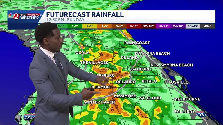
Heavy late afternoon showers and storms may pose flood concerns for Central Florida as a warming trend continues through the weekend. A system of high pressure is expected to sag towards the south, bringing a strong influx of moisture from the Gulf Coast and allowing for 70% coverage of showers on Saturday and Sunday.
Weekend Forecast
The westernmost communities, including those just outside of I-4, are expected to see the most significant rain, with pockets possibly pushing past 3 to 5 inches. This rain is expected to bring some relief to the severe drought that has been affecting the area, particularly across I-75.
Temperatures are expected to peak in the mid-90s, with a weak east coast breeze allowing for isolated showers. The forecast for Orlando shapes up with a better chance for rain over the course of the next two hours, trending cloudy throughout the evening, and dropping back into the low and mid-70s tonight.
Original reporting: WESH Orlando — read the source article.


