Chief meteorologist Jay Cardosi talks about the beautiful Monday night weather and when chances for strong storms will make a return. On Monday, the weather was partly cloudy with a west-southwesterly wind at 6 miles per hour. Temperatures were in the 70s and were expected to drop into the 60s overnight.
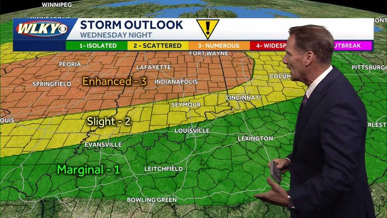
According to Cardosi, there is a slight chance for a spotty shower or storm on Tuesday, with the greatest chances in the northern part of the viewing area. However, the main concern is for Wednesday night into Thursday, when a line of storms is expected to develop ahead of a cold front. This system has a lot of energy, wind, and moisture, which could lead to strong to severe storms.
The storms are expected to line up in between Indy and Seymour, approaching the Ohio River around 3-4 am on Thursday. The atmosphere is expected to be pretty juiced, even late at night, so the scenario needs to be watched closely for strong and severe storms. On Thursday, there is a threat for severe weather, most notably late Wednesday night, with the greatest chances to the north of the viewing area.
The good news is that the active pattern is expected to clear up just in time for Father’s Day weekend, with Saturday looking great. Cardosi will continue to keep viewers posted on the latest developments.
Original reporting: WLKY Louisville — read the source article.


