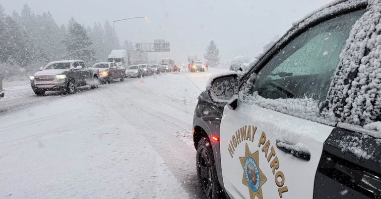
Reno residents are facing the region’s first significant winter storm of the season, with the National Weather Service forecasting rain for the city, heavy wet snow in the Sierra, and gusts of 45‑55 mph in exposed valleys. Snowfall rates of one to two inches per hour are expected on the Sierra Crest, potentially producing a foot of snow above 7,000 feet and up to two feet along the crest, according to a report from mynews4.com.
In response, the Nevada Department of Transportation (NDOT) has imposed chain controls on Interstate 80. Westbound traffic is being released at the Nevada‑California state line under R2 restrictions, while eastbound traffic remains held at Donner Summit after multiple spinouts, as detailed by 2news.com and mynews4.com. Chains are required on all vehicles except four‑wheel‑drive vehicles with snow tires on the westbound stretch from the Donner Lake Interchange to Kingvale, and on the Mt. Rose Highway, where drivers are urged to slow down, leave extra space, and check Nevada 511 for updates.
Travelers through the Sierra should anticipate delays. The California Highway Patrol in Truckee reported that eastbound traffic was briefly allowed to resume before additional spinouts forced officials to hold vehicles again, and no release time has been announced (mynews4.com). Motorists are encouraged to carry chains, follow posted restrictions, and use caution, especially on bridges, ramps, overpasses and shaded areas that may freeze early.
Reno’s Streets Division is prepared for winter operations. Tim Hendricks, the division manager, said the city has stocked up on salt, sand and brine, completed winter inspections on equipment, and has 22 plow trucks plus four dedicated cul‑de‑sac units ready. Regular winter shifts begin Monday at 3 a.m., with day and night crews available for major storms, according to mynews4.com. Hendricks advised drivers to give snowplows room, noting that a 60,000‑pound piece of equipment needs space to clear snow and ice.
Forecasters expect colder air to linger, with additional storms moving through the region Friday night into early Saturday, again Sunday‑Monday, and later Wednesday‑Thursday. Snowfall rates could reach 1‑2 inches per hour through early Friday night, and rain totals in the valley are projected at .05‑.30 inches by Saturday morning, with localized amounts near a half inch, per 2news.com. The pattern suggests cooler than average temperatures, raising the possibility of snow reaching the valley floor next week.
What’s next: Motorists should monitor NDOT’s 511 alerts and local news for updates on chain‑control releases. Reno crews will continue night‑time operations as needed, and the next major storm is expected to arrive Wednesday, potentially bringing additional snow to the valley floor.
Sources: 2news.com, 2news.com, mynews4.com, mynews4.com